Living in Maltby
Maltby is a town in Rotherham, Yorkshire and The Humber, England. This guide describes it as one place — who lives there, what sits inside its boundary and how safe it is — from official UK data. For any single street, the NestScope area report covers every Maltby postcode.
Maltby is a town of 16,305 people at 2,076 per km², where 24% of residents live in neighbourhoods in England's better-off half. 6 of its 7 inspected schools are rated Good or Outstanding, and it recorded 9.6 crimes per 1,000 residents a month.
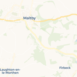
 © OpenStreetMap · © CARTO
What's in Maltby: schools, GPs, stations, parks and shops
Counted inside the town boundary. A school or station two streets past it belongs to the next place.
Best-rated schools in Maltby
Ranked by Ofsted grade.
Maltby crime rate
9.6crimes per 1,000 residents a month inside the town boundary · 2026-06 to 2026-08
Fewer than the median English town of this size (9.8) · 157 recorded crimes a month in all
- Is Maltby a good place to live?
- Maltby has 16,305 residents, 24% of them in neighbourhoods in England's better-off half, 86% of its inspected schools are rated Good or Outstanding, and recorded crime (9.6 per 1,000 a month) is below the median English town of its size (9.8). Whether it is a good place to live depends on the street: the NestScope area report scores any Maltby postcode.
- Is Maltby safe?
- Maltby recorded 9.6 crimes per 1,000 residents a month inside the town boundary over 2026-06 to 2026-08 (police.uk), against 9.8 for the median English town of this size. The largest category was violent.
- How many people live in Maltby?
- 16,305 people live in Maltby (Census 2021, ONS built-up area), across 7.9 km² — about 2,076 per km².
- What are the schools like in Maltby?
- There are 7 schools inside Maltby; 86% of those inspected are rated Good or Outstanding by Ofsted. The top-rated include Maltby Academy, Hilltop School and Maltby Lilly Hall Academy.
- Where is Maltby?
- Maltby is a town in Rotherham, Yorkshire and The Humber, England.
This page is NestScope's guide to Maltby as a whole town, built from the same official sources as the area reports: the ONS boundary of the built-up area, Census 2021, the English Indices of Deprivation, police.uk recorded crime and the Department for Education's school register. Counts are of what sits inside the boundary; crime is a three-month average. It is updated as those sources publish.
Sources — ONS built-up areas 2022, Output Area lookups and Census 2021 (OGL v3.0) · English Indices of Deprivation 2019, carried onto 2021 LSOAs · police.uk street-level crime, the town boundary passed as the query polygon · DfE GIAS + Ofsted, NHS ODS, NaPTAN, OS Open Greenspace, Geolytix, Arts Council — every point counted by which 2021 neighbourhood it falls in.