About SE1 7RH
SE1 7RH scores 60/100 on the NestScope Score, with its strongest showing in local amenities and transport — with Iceland Lower Marsh within a short walk. The breakdown below draws on official UK data covering schools, safety, healthcare, transport, environment and local amenities.
In national context, SE1 7RH is a mixed, mid-ranking neighbourhood — IMD decile 3/10, ranked 8,211 of 32,844 neighbourhoods in England. The Index of Multiple Deprivation is the UK government's official measure of relative deprivation, refreshed roughly every five years. Housing pressure here is high (IMD housing decile 2/10).
There are 154 schools within the typical catchment area, including 24 rated Outstanding by Ofsted and 52 rated Good. The nearest school is Oasis Academy South Bank Primary (Ofsted: Good), within a short walk.
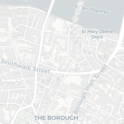
Healthcare access is good, with 78 GP surgeries, 7 hospitals and 79 dental practices in the wider neighbourhood. The nearest GP practice is LAS S.E. LONDON IUC CAS, about 2 minutes' walk away. The nearest hospital is ST THOMAS' HOSPITAL, about 7 minutes' walk away. A pharmacy is within a short walk.
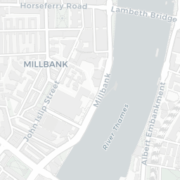
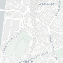
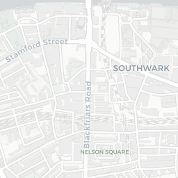
The nearest rail stations are London Waterloo Rail Station (Train, about 4 minutes' walk away), London Waterloo East Rail Station (Train, about 5 minutes' walk away), Lambeth North Underground Station (Tube/Metro, about 3 minutes' walk away), Lambeth North Underground Station (Tube/Metro, about 3 minutes' walk away), Waterloo Underground Station (Tube/Metro, about 4 minutes' walk away). There are also 64 bus stops within walking distance.
The location sits in Flood Zone 3 (high risk — between a 1 in 100 and 1 in 200 annual chance of river or sea flooding), which may affect insurance and mortgage availability. rail noise is low (about 54 dB Lden).
There are 31 green spaces within walking distance, totalling 15.6 hectares of parks and outdoor space. The nearest is Waterloo Millennium Green, within a short walk.
There are 193 supermarkets in the wider area, including Iceland, Tesco, The Co-operative Group, Marks and Spencer and others. The nearest is Iceland Lower Marsh, within a short walk. A public library is about 4 minutes' walk away.
Sources: DfE/Ofsted, UK Police API, NHS ODS, NaPTAN, Environment Agency, Ordnance Survey, Natural England, DEFRA, Geolytix and Arts Council England. For an interactive map view, explore SE1 7RH on NestScope.