NestScope
SE1 7AZ · Neighbourhood Report
© OpenStreetMap · © CARTO
Area Report
Last updated 12 JUN 2026

SE1 7AZ

Neighbourhood Report

What's nearby — across walking, short-drive and school catchment distance. Data from official UK government sources.

NestScope Score
59/ 100

A mixed, mid-ranking neighbourhood

Anchored on official IMD data — decile 3/10, ranked 8,211 of 32,844 neighbourhoods in England.

How this score is calculated
01 — Snapshot

Around SE1 7AZ.

The large figure is how many we found nearby; the chip beside each label is that category’s NestScope score out of 100 — higher beats more of the UK.

Schools76/100
19Good/Outstanding within 1 mi

79 rated Good or better within 2 mi · 160 schools in total

Nearest top-rated: Oasis Academy South Bank Primary (Good) — 0.0 mi

Safety50/100
221crimes last month

IMD crime decile 5/10 · 221 crimes in 400m last month (residential-weighted: 128.9)

Crimes reported last month · UK Police API

Healthcare76/100
85GP & hospitals

IMD health decile 3/10 · 78 GP, 7 hospitals, 80 dentists, pharmacy 0.1 mi within 1.5 mi

Nearest GP: LAS S.E. LONDON IUC CAS — 0.1 mi

Transport84/100
London Waterloo Rail Station0.2 mi
London Waterloo East Rail Station0.2 mi
Lambeth North Underground Station0.2 mi
Waterloo Underground Station0.2 mi

67 bus stops also within 0.5 miles

Green space57/100
33green spaces

IMD environment decile 1/10 · 15.6 ha total — no proper park nearby

Nearest: Sports Facility (700 m²) — 0.1 mi

Amenities91/100
191supermarkets

191 supermarkets within 2 mi — Tesco, Iceland, Sainsburys, Marks and Spencer… — nearest 0.1 mi — library 0.2 mi

Nearest: Tesco Waterloo Baylis Express — 0.1 mi

02 — Environment

Environment & risk near SE1 7AZ.

Official risk flags for context — deliberately not part of the NestScope score (they’re categorical hazards, not amenities).

Flood risk
Zone 1 (low)

Flood Zone 1 — low risk (less than 1 in 1,000 annual chance) · Source: Environment Agency Flood Map for Planning

Zone 1
Zone 2
Zone 3
Air qualityModerate
29.3µg/m³

NO₂ annual mean · WHO guideline 10 · UK limit 40 · Source: DEFRA UK-AIR 2024

<10
10–20
20–30
30–40
≥40
03 — House prices

Sold prices in SE1.

Average sold price by property type across the SE1 district, 202120264,704 sales.

£0£1M£2M£3M202120222023202420252026
  • Detached
  • Semi-detached
  • Terraced
  • Flat
Detached
Semi-detached£1.0M 29.4%
Terraced£678k 34.2%
Flat£593k 35.8%

District-level averages (SE1) — broad enough to show a reliable trend. A single postcode usually sees too few sales to chart. Source: HM Land Registry Price Paid Data (Crown Copyright / OGL v3.0).

About SE1 7AZ

SE1 7AZ scores 59/100 on the NestScope Score, with its strongest showing in local amenities and transport — with Tesco Waterloo Baylis Express about 2 minutes' walk away. The breakdown below draws on official UK data covering schools, safety, healthcare, transport, environment and local amenities.

In national context, SE1 7AZ is a mixed, mid-ranking neighbourhood — IMD decile 3/10, ranked 8,211 of 32,844 neighbourhoods in England. The Index of Multiple Deprivation is the UK government's official measure of relative deprivation, refreshed roughly every five years. Housing pressure here is high (IMD housing decile 2/10).

There are 160 schools within the typical catchment area, including 25 rated Outstanding by Ofsted and 54 rated Good. The nearest school is Oasis Academy South Bank Primary (Ofsted: Good), within a short walk.

There were 221 crimes reported on the surrounding streets in the most recent month, indicating a high level of immediate-area crime.

Healthcare access is good, with 78 GP surgeries, 7 hospitals and 80 dental practices in the wider neighbourhood. The nearest GP practice is LAS S.E. LONDON IUC CAS, within a short walk. The nearest hospital is ST THOMAS' HOSPITAL, about 8 minutes' walk away. A pharmacy is within a short walk.

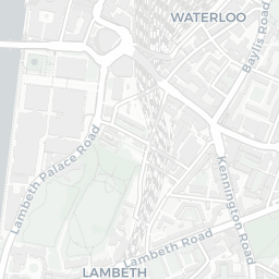
The nearest rail stations are London Waterloo Rail Station (Train, about 4 minutes' walk away), London Waterloo East Rail Station (Train, about 5 minutes' walk away), Lambeth North Underground Station (Tube/Metro, about 3 minutes' walk away), Lambeth North Underground Station (Tube/Metro, about 3 minutes' walk away), Waterloo Underground Station (Tube/Metro, about 4 minutes' walk away). There are also 67 bus stops within walking distance.

The location is in Flood Zone 1 (low risk — less than a 1 in 1,000 annual chance of river or sea flooding).

There are 33 green spaces within walking distance, totalling 15.6 hectares of parks and outdoor space. The nearest is Sports Facility (700 m²), within a short walk.

There are 191 supermarkets in the wider area, including Tesco, Iceland, Sainsburys, Marks and Spencer and others. The nearest is Tesco Waterloo Baylis Express, about 2 minutes' walk away. A public library is about 4 minutes' walk away.

Sources: DfE/Ofsted, UK Police API, NHS ODS, NaPTAN, Environment Agency, Ordnance Survey, Natural England, DEFRA, Geolytix and Arts Council England. For an interactive map view, explore SE1 7AZ on NestScope.

Explore area insights about nearby locations

Data: DfE/Ofsted · UK Police API · NHS ODS · NaPTAN · Ordnance Survey · Geolytix. Crown Copyright / OGL. Look up any postcode: nestscope.uk/area/YOUR+POSTCODE — e.g. SW1A 1AA, M1 1AE, BS1 1HT.

NestScope

All data from publicly available UK government sources. Each dimension uses a category-appropriate radius (walking distance for crime and transport, school catchment, drive distance for healthcare). IMD context is the latest published English Indices of Deprivation (2019). This report is for informational purposes only.