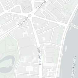
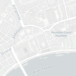
NestScope
WC2R 2PP · Neighbourhood Report
© OpenStreetMap · © CARTO
Area Report
Last updated 13 JUN 2026

WC2R 2PP

Neighbourhood Report

What's nearby — across walking, short-drive and school catchment distance. Data from official UK government sources.

NestScope Score
57/ 100

A more affordable, lower-income neighbourhood

Anchored on official IMD data — decile 2/10, ranked 5,794 of 32,844 neighbourhoods in England.

How this score is calculated
01 — Snapshot

Around WC2R 2PP.

The large figure is how many we found nearby; the chip beside each label is that category’s NestScope score out of 100 — higher beats more of the UK.

Schools87/100
10Good/Outstanding within 1 mi

75 rated Good or better within 2 mi · 160 schools in total

Nearest top-rated: Oasis Academy South Bank Primary (Good) — 0.7 mi

Safety59/100
133crimes last month

IMD crime decile 7/10 · 133 crimes in 400m last month (residential-weighted: 73.3)

Crimes reported last month · UK Police API

Healthcare75/100
100GP & hospitals

IMD health decile 3/10 · 82 GP, 18 hospitals, 108 dentists, pharmacy 0.1 mi within 1.5 mi

Nearest GP: KINGS COLLEGE HEALTH CENTRE — 0.2 mi

Transport74/100
London Charing Cross Rail Station0.4 mi
London Waterloo Rail Station0.5 mi
Temple Underground Station0.1 mi
Embankment Underground Station0.3 mi

59 bus stops also within 0.5 miles

Green space54/100
12green spaces

IMD environment decile 1/10 · 10.7 ha total — no proper park nearby

Nearest: Victoria Embankment Gardens — 0.2 mi

Amenities94/100
207supermarkets

207 supermarkets within 2 mi — Tesco, Marks and Spencer, The Co-operative Group, Sainsburys… — nearest 0.1 mi — library 0.5 mi

Nearest: Tesco Strand Express — 0.1 mi

02 — Environment

Environment & risk near WC2R 2PP.

Official risk flags for context — deliberately not part of the NestScope score (they’re categorical hazards, not amenities).

Flood risk
Zone 3 (high)

Flood Zone 3 — high risk (1 in 100 annual chance) · Source: Environment Agency Flood Map for Planning

Zone 1
Zone 2
Zone 3
Air qualityHigh (approaching UK limit)
33.1µg/m³

NO₂ annual mean · WHO guideline 10 · UK limit 40 · Source: DEFRA UK-AIR 2024

<10
10–20
20–30
30–40
≥40
Road noiseLoud
70dB Lden

Road traffic, day-evening-night average · Source: DEFRA strategic noise mapping

<55
55–64
65–74
≥75
Rail noiseModerate
60dB Lden

Railways, day-evening-night average · Source: DEFRA strategic noise mapping

<55
55–64
65–74
≥75
03 — House prices

Sold prices in WC2R.

Average sold price by property type across the WC2R district, 2021202649 sales.

£0£1M£2M£3M20212022202320242025
  • Flat
Flat£1.8M 68.4%

District-level averages (WC2R) — broad enough to show a reliable trend. A single postcode usually sees too few sales to chart. Source: HM Land Registry Price Paid Data (Crown Copyright / OGL v3.0).

About WC2R 2PP

WC2R 2PP scores 57/100 on the NestScope Score, with its strongest showing in local amenities and schools — with Tesco Strand Express about 2 minutes' walk away. The breakdown below draws on official UK data covering schools, safety, healthcare, transport, environment and local amenities.

In national context, WC2R 2PP is a more affordable, lower-income neighbourhood — IMD decile 2/10, ranked 5,794 of 32,844 neighbourhoods in England. The Index of Multiple Deprivation is the UK government's official measure of relative deprivation, refreshed roughly every five years. Housing pressure here is high (IMD housing decile 4/10).

There are 160 schools within the typical catchment area, including 26 rated Outstanding by Ofsted and 49 rated Good. The nearest school is Courtauld Institute of Art, within a short walk.

There were 133 crimes reported on the surrounding streets in the most recent month, indicating a high level of immediate-area crime.

Healthcare access is good, with 82 GP surgeries, 18 hospitals and 108 dental practices in the wider neighbourhood. The nearest GP practice is KINGS COLLEGE HEALTH CENTRE, about 3 minutes' walk away. The nearest hospital is ST THOMAS' HOSPITAL, 0.8 mi away. A pharmacy is about 3 minutes' walk away.

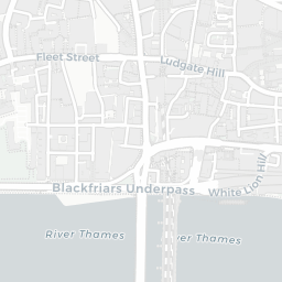
The nearest rail stations are London Charing Cross Rail Station (Train, about 7 minutes' walk away), London Waterloo Rail Station (Train, about 10 minutes' walk away), Temple Underground Station (Tube/Metro, about 2 minutes' walk away), Temple Underground Station (Tube/Metro, about 3 minutes' walk away), Embankment Underground Station (Tube/Metro, about 6 minutes' walk away). There are also 59 bus stops within walking distance.

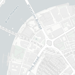
The location sits in Flood Zone 3 (high risk — between a 1 in 100 and 1 in 200 annual chance of river or sea flooding), which may affect insurance and mortgage availability. road traffic noise is high (about 70 dB Lden), and rail noise is moderate (about 60 dB Lden).

There are 12 green spaces within walking distance, totalling 10.7 hectares of parks and outdoor space. The nearest is Victoria Embankment Gardens, about 4 minutes' walk away.

There are 207 supermarkets in the wider area, including Tesco, Marks and Spencer, The Co-operative Group, Sainsburys and others. The nearest is Tesco Strand Express, about 2 minutes' walk away. A public library is about 9 minutes' walk away.

Sources: DfE/Ofsted, UK Police API, NHS ODS, NaPTAN, Environment Agency, Ordnance Survey, Natural England, DEFRA, Geolytix and Arts Council England. For an interactive map view, explore WC2R 2PP on NestScope.

Explore area insights about nearby locations

Data: DfE/Ofsted · UK Police API · NHS ODS · NaPTAN · Ordnance Survey · Geolytix. Crown Copyright / OGL. Look up any postcode: nestscope.uk/area/YOUR+POSTCODE — e.g. SW1A 1AA, M1 1AE, BS1 1HT.

NestScope

All data from publicly available UK government sources. Each dimension uses a category-appropriate radius (walking distance for crime and transport, school catchment, drive distance for healthcare). IMD context is the latest published English Indices of Deprivation (2019). This report is for informational purposes only.