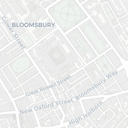
NestScope
WC2B 6TD · Neighbourhood Report
© OpenStreetMap · © CARTO
Area Report
Last updated 12 JUN 2026

WC2B 6TD

Neighbourhood Report

What's nearby — across walking, short-drive and school catchment distance. Data from official UK government sources.

NestScope Score
64/ 100

An above-average neighbourhood

Anchored on official IMD data — decile 5/10, ranked 13,788 of 32,844 neighbourhoods in England.

How this score is calculated
01 — Snapshot

Around WC2B 6TD.

The large figure is how many we found nearby; the chip beside each label is that category’s NestScope score out of 100 — higher beats more of the UK.

Schools74/100
6Good/Outstanding within 1 mi

71 rated Good or better within 2 mi · 151 schools in total

Nearest top-rated: Children's Hospital School at Gt Ormond Street and UCH (Outstanding) — 0.5 mi

Safety48/100

IMD crime decile 4/10 · live count unavailable

Data temporarily unavailable

Healthcare93/100
92GP & hospitals

IMD health decile 9/10 · 74 GP, 18 hospitals, 129 dentists, pharmacy 0.1 mi within 1.5 mi

Nearest GP: ST PHILIPS MEDICAL CENTRE — 0.2 mi

Transport84/100
Holborn Underground Station0.1 mi
Covent Garden Underground Station0.3 mi

61 bus stops also within 0.5 miles

Green space54/100
18green spaces

IMD environment decile 1/10 · 11.9 ha total — no proper park nearby

Nearest: Lincoln's Inn Fields — 0.1 mi

Amenities94/100
204supermarkets

204 supermarkets within 2 mi — Waitrose, Sainsburys, The Co-operative Group, Tesco… — nearest 0.1 mi — library 0.4 mi

Nearest: Little Waitrose High Holborn — 0.1 mi

02 — Environment

Environment & risk near WC2B 6TD.

Official risk flags for context — deliberately not part of the NestScope score (they’re categorical hazards, not amenities).

Flood risk
Zone 1 (low)

Flood Zone 1 — low risk (less than 1 in 1,000 annual chance) · Source: Environment Agency Flood Map for Planning

Zone 1
Zone 2
Zone 3
Air qualityHigh (approaching UK limit)
33.1µg/m³

NO₂ annual mean · WHO guideline 10 · UK limit 40 · Source: DEFRA UK-AIR 2024

<10
10–20
20–30
30–40
≥40
Road noiseLoud
79dB Lden

Road traffic, day-evening-night average · Source: DEFRA strategic noise mapping

<55
55–64
65–74
≥75
03 — House prices

Sold prices in WC2B.

Average sold price by property type across the WC2B district, 20212026124 sales.

£0£500k£1M£1.5M20212022202320242025
  • Flat
Flat£1.3M 14.6%

District-level averages (WC2B) — broad enough to show a reliable trend. A single postcode usually sees too few sales to chart. Source: HM Land Registry Price Paid Data (Crown Copyright / OGL v3.0).

About WC2B 6TD

WC2B 6TD scores 64/100 on the NestScope Score, with its strongest showing in local amenities and healthcare — with Little Waitrose High Holborn about 3 minutes' walk away. The breakdown below draws on official UK data covering schools, safety, healthcare, transport, environment and local amenities.

In national context, WC2B 6TD is an above-average neighbourhood — IMD decile 5/10, ranked 13,788 of 32,844 neighbourhoods in England. The Index of Multiple Deprivation is the UK government's official measure of relative deprivation, refreshed roughly every five years. Housing pressure here is high (IMD housing decile 4/10).

There are 151 schools within the typical catchment area, including 27 rated Outstanding by Ofsted and 44 rated Good. The nearest school is City Lit, within a short walk.

Healthcare access is good, with 74 GP surgeries, 18 hospitals and 129 dental practices in the wider neighbourhood. The nearest GP practice is ST PHILIPS MEDICAL CENTRE, about 4 minutes' walk away. The nearest hospital is THE ITALIAN HOSPITAL, about 8 minutes' walk away. A pharmacy is about 2 minutes' walk away.

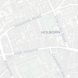
The nearest rail stations are Holborn Underground Station (Tube/Metro, about 3 minutes' walk away), Holborn Underground Station (Tube/Metro, about 3 minutes' walk away), Covent Garden Underground Station (Tube/Metro, about 6 minutes' walk away). There are also 61 bus stops within walking distance.

The location is in Flood Zone 1 (low risk — less than a 1 in 1,000 annual chance of river or sea flooding). road traffic noise is very high (about 79 dB Lden).

There are 18 green spaces within walking distance, totalling 11.9 hectares of parks and outdoor space. The nearest is Lincoln's Inn Fields, about 3 minutes' walk away.

There are 204 supermarkets in the wider area, including Waitrose, Sainsburys, The Co-operative Group, Tesco and others. The nearest is Little Waitrose High Holborn, about 3 minutes' walk away. A public library is about 8 minutes' walk away.

Sources: DfE/Ofsted, UK Police API, NHS ODS, NaPTAN, Environment Agency, Ordnance Survey, Natural England, DEFRA, Geolytix and Arts Council England. For an interactive map view, explore WC2B 6TD on NestScope.

Explore area insights about nearby locations

Data: DfE/Ofsted · UK Police API · NHS ODS · NaPTAN · Ordnance Survey · Geolytix. Crown Copyright / OGL. Look up any postcode: nestscope.uk/area/YOUR+POSTCODE — e.g. SW1A 1AA, M1 1AE, BS1 1HT.

NestScope

All data from publicly available UK government sources. Each dimension uses a category-appropriate radius (walking distance for crime and transport, school catchment, drive distance for healthcare). IMD context is the latest published English Indices of Deprivation (2019). This report is for informational purposes only.