NestScope
W6 7BE · Neighbourhood Report
© OpenStreetMap · © CARTO
Area Report
Last updated 13 JUN 2026

W6 7BE

Neighbourhood Report

What's nearby — across walking, short-drive and school catchment distance. Data from official UK government sources.

NestScope Score
70/ 100

An above-average neighbourhood

Anchored on official IMD data — decile 6/10, ranked 19,649 of 32,844 neighbourhoods in England.

How this score is calculated
01 — Snapshot

Around W6 7BE.

The large figure is how many we found nearby; the chip beside each label is that category’s NestScope score out of 100 — higher beats more of the UK.

Schools93/100
27Good/Outstanding within 1 mi

83 rated Good or better within 2 mi · 152 schools in total

Nearest top-rated: St Mary's Catholic Primary School (Good) — 0.2 mi

Safety45/100
48crimes last month

IMD crime decile 4/10 · 48 crimes in 400m last month (residential-weighted: 35.2)

Crimes reported last month · UK Police API

Healthcare84/100
48GP & hospitals

IMD health decile 6/10 · 46 GP, 2 hospitals, 60 dentists, pharmacy 0.1 mi within 1.5 mi

Nearest GP: LLR VIRTUAL CARE — 0.2 mi

Transport91/100
Kensington (Olympia) Rail Station0.4 mi
Hammersmith (H&C Line) Underground Station0.3 mi
Hammersmith (Dist&Picc Line) Underground Station0.3 mi
Kensington (Olympia) Underground Station0.4 mi

40 bus stops also within 0.5 miles

Green space48/100
9green spaces

IMD environment decile 1/10 · 4.3 ha total — no proper park nearby

Nearest: Playground (0.15 ha) — 0.1 mi

Amenities95/100
115supermarkets

115 supermarkets within 2 mi — Tesco, Sainsburys, Marks and Spencer, Lidl… — nearest 0.3 mi — library 0.2 mi

Nearest: Tesco Hammersmith Superstore — 0.3 mi

02 — Environment

Environment & risk near W6 7BE.

Official risk flags for context — deliberately not part of the NestScope score (they’re categorical hazards, not amenities).

Flood risk
Zone 3 (high)

Flood Zone 3 — high risk (1 in 100 annual chance) · Source: Environment Agency Flood Map for Planning

Zone 1
Zone 2
Zone 3
Air qualityModerate
23.1µg/m³

NO₂ annual mean · WHO guideline 10 · UK limit 40 · Source: DEFRA UK-AIR 2024

<10
10–20
20–30
30–40
≥40
Road noiseModerate
57dB Lden

Road traffic, day-evening-night average · Source: DEFRA strategic noise mapping

<55
55–64
65–74
≥75
03 — House prices

Sold prices in W6.

Average sold price by property type across the W6 district, 202120262,701 sales.

£0£1M£2M£3M202120222023202420252026
  • Detached
  • Semi-detached
  • Terraced
  • Flat
Detached£2.3M 41.4%
Semi-detached£1.8M 1.2%
Terraced£1.4M 0.5%
Flat£562k 10.3%

District-level averages (W6) — broad enough to show a reliable trend. A single postcode usually sees too few sales to chart. Source: HM Land Registry Price Paid Data (Crown Copyright / OGL v3.0).

About W6 7BE

W6 7BE scores 70/100 on the NestScope Score, with its strongest showing in local amenities and schools — with Tesco Hammersmith Superstore about 5 minutes' walk away. The breakdown below draws on official UK data covering schools, safety, healthcare, transport, environment and local amenities.

In national context, W6 7BE is an above-average neighbourhood — IMD decile 6/10, ranked 19,649 of 32,844 neighbourhoods in England. The Index of Multiple Deprivation is the UK government's official measure of relative deprivation, refreshed roughly every five years. Housing pressure here is moderate (IMD housing decile 5/10).

There are 152 schools within the typical catchment area, including 29 rated Outstanding by Ofsted and 54 rated Good. The nearest school is Ecole Française de Londres Jacques Prévert, within a short walk.

There were 48 crimes reported on the surrounding streets in the most recent month, indicating a elevated level of immediate-area crime.

Healthcare access is good, with 46 GP surgeries, 2 hospitals and 60 dental practices in the wider neighbourhood. The nearest GP practice is LLR VIRTUAL CARE, about 5 minutes' walk away. The nearest hospital is CHARING CROSS HOSPITAL, about 13 minutes' walk away. A pharmacy is about 2 minutes' walk away.

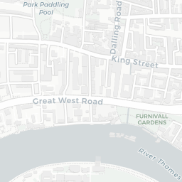
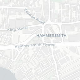
The nearest rail stations are Kensington (Olympia) Rail Station (Train, about 8 minutes' walk away), Hammersmith (H&C Line) Underground Station (Tube/Metro, about 6 minutes' walk away), Hammersmith (Dist&Picc Line) Underground Station (Tube/Metro, about 7 minutes' walk away), Kensington (Olympia) Underground Station (Tube/Metro, about 8 minutes' walk away). There are also 40 bus stops within walking distance.

The location sits in Flood Zone 3 (high risk — between a 1 in 100 and 1 in 200 annual chance of river or sea flooding), which may affect insurance and mortgage availability. road traffic noise is moderate (about 57 dB Lden).

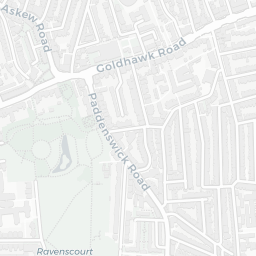
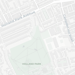
There are 9 green spaces within walking distance, totalling 4.3 hectares of parks and outdoor space. The nearest is Playground (0.15 ha), within a short walk.

There are 115 supermarkets in the wider area, including Tesco, Sainsburys, Marks and Spencer, Lidl and others. The nearest is Tesco Hammersmith Superstore, about 5 minutes' walk away. A public library is about 5 minutes' walk away.

Sources: DfE/Ofsted, UK Police API, NHS ODS, NaPTAN, Environment Agency, Ordnance Survey, Natural England, DEFRA, Geolytix and Arts Council England. For an interactive map view, explore W6 7BE on NestScope.

Explore area insights about nearby locations

Data: DfE/Ofsted · UK Police API · NHS ODS · NaPTAN · Ordnance Survey · Geolytix. Crown Copyright / OGL. Look up any postcode: nestscope.uk/area/YOUR+POSTCODE — e.g. SW1A 1AA, M1 1AE, BS1 1HT.

NestScope

All data from publicly available UK government sources. Each dimension uses a category-appropriate radius (walking distance for crime and transport, school catchment, drive distance for healthcare). IMD context is the latest published English Indices of Deprivation (2019). This report is for informational purposes only.