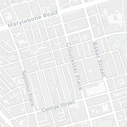
NestScope
W1B 1NB · Neighbourhood Report
© OpenStreetMap · © CARTO
Area Report
Last updated 15 JUN 2026

W1B 1NB

Neighbourhood Report

What's nearby — across walking, short-drive and school catchment distance. Data from official UK government sources.

NestScope Score
70/ 100

An above-average neighbourhood

Anchored on official IMD data — decile 6/10, ranked 18,090 of 32,844 neighbourhoods in England.

How this score is calculated
01 — Snapshot

Around W1B 1NB.

The large figure is how many we found nearby; the chip beside each label is that category’s NestScope score out of 100 — higher beats more of the UK.

Schools68/100
11Good/Outstanding within 1 mi

64 rated Good or better within 2 mi · 141 schools in total

Nearest top-rated: St Vincent's Catholic Primary School (Outstanding) — 0.4 mi

Safety64/100
148crimes last month

IMD crime decile 8/10 · 148 crimes in 400m last month (residential-weighted: 99.7)

Crimes reported last month · UK Police API

Healthcare90/100
93GP & hospitals

IMD health decile 8/10 · 73 GP, 20 hospitals, 106 dentists, pharmacy 0.1 mi within 1.5 mi

Nearest GP: RTN MEDICAL ADHD: DEVON ICB — 0.1 mi

Transport89/100
Regent's Park Underground Station0.2 mi
Great Portland Street Underground Station0.3 mi
Oxford Circus Underground Station0.3 mi

41 bus stops also within 0.5 miles

Green space53/100
15green spaces

IMD environment decile 2/10 · 7.4 ha total — no proper park nearby

Nearest: Crescent Gardens — 0.2 mi

Amenities95/100
161supermarkets

161 supermarkets within 2 mi — Sainsburys, Tesco, Waitrose, Marks and Spencer… — nearest 0.1 mi — library 0.3 mi

Nearest: Sainsburys Great Portland Street Local — 0.1 mi

02 — Environment

Environment & risk near W1B 1NB.

Official risk flags for context — deliberately not part of the NestScope score (they’re categorical hazards, not amenities).

Flood risk
Zone 1 (low)

Flood Zone 1 — low risk (less than 1 in 1,000 annual chance) · Source: Environment Agency Flood Map for Planning

Zone 1
Zone 2
Zone 3
Air qualityModerate
29.8µg/m³

NO₂ annual mean · WHO guideline 10 · UK limit 40 · Source: DEFRA UK-AIR 2024

<10
10–20
20–30
30–40
≥40
03 — House prices

Sold prices in W1B.

Average sold price by property type across the W1B district, 2021202696 sales.

£0£5M£10M£15M£20M20212022202320242025
  • Detached
  • Semi-detached
  • Terraced
  • Flat
Detached
Semi-detached
Terraced£7.3M
Flat£1.7M 66.7%

District-level averages (W1B) — broad enough to show a reliable trend. A single postcode usually sees too few sales to chart. Source: HM Land Registry Price Paid Data (Crown Copyright / OGL v3.0).

About W1B 1NB

W1B 1NB scores 70/100 on the NestScope Score, with its strongest showing in local amenities and healthcare — with Sainsburys Great Portland Street Local about 3 minutes' walk away. The breakdown below draws on official UK data covering schools, safety, healthcare, transport, environment and local amenities.

In national context, W1B 1NB is an above-average neighbourhood — IMD decile 6/10, ranked 18,090 of 32,844 neighbourhoods in England. The Index of Multiple Deprivation is the UK government's official measure of relative deprivation, refreshed roughly every five years. Housing pressure here is high (IMD housing decile 4/10).

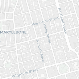
There are 141 schools within the typical catchment area, including 22 rated Outstanding by Ofsted and 42 rated Good. The nearest school is Eifa International School, within a short walk.

There were 148 crimes reported on the surrounding streets in the most recent month, indicating a high level of immediate-area crime.

Healthcare access is good, with 73 GP surgeries, 20 hospitals and 106 dental practices in the wider neighbourhood. The nearest GP practice is RTN MEDICAL ADHD: DEVON ICB, about 2 minutes' walk away. The nearest hospital is PORTLAND HOSPITAL, about 4 minutes' walk away. A pharmacy is about 2 minutes' walk away.

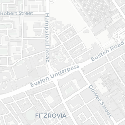
The nearest rail stations are Regent's Park Underground Station (Tube/Metro, about 5 minutes' walk away), Great Portland Street Underground Station (Tube/Metro, about 5 minutes' walk away), Oxford Circus Underground Station (Tube/Metro, about 7 minutes' walk away). There are also 41 bus stops within walking distance.

The location is in Flood Zone 1 (low risk — less than a 1 in 1,000 annual chance of river or sea flooding).

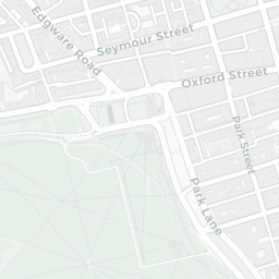
There are 15 green spaces within walking distance, totalling 7.4 hectares of parks and outdoor space. The nearest is Crescent Gardens, about 5 minutes' walk away.

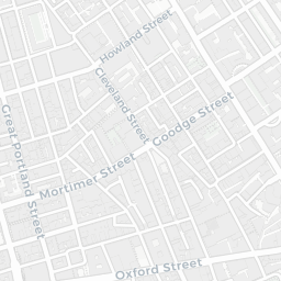
There are 161 supermarkets in the wider area, including Sainsburys, Tesco, Waitrose, Marks and Spencer and others. The nearest is Sainsburys Great Portland Street Local, about 3 minutes' walk away. A public library is about 5 minutes' walk away.

Sources: DfE/Ofsted, UK Police API, NHS ODS, NaPTAN, Environment Agency, Ordnance Survey, Natural England, DEFRA, Geolytix and Arts Council England. For an interactive map view, explore W1B 1NB on NestScope.

Explore area insights about nearby locations

Data: DfE/Ofsted · UK Police API · NHS ODS · NaPTAN · Ordnance Survey · Geolytix. Crown Copyright / OGL. Look up any postcode: nestscope.uk/area/YOUR+POSTCODE — e.g. SW1A 1AA, M1 1AE, BS1 1HT.