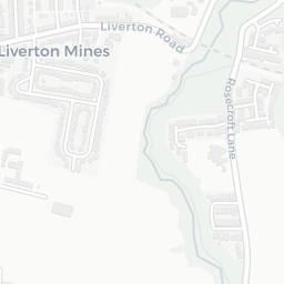
NestScope
TS12 2TZ · Neighbourhood Report
© OpenStreetMap · © CARTO
Area Report
Last updated 13 JUN 2026

TS12 2TZ

Neighbourhood Report

What's nearby — across walking, short-drive and school catchment distance. Data from official UK government sources.

NestScope Score
47/ 100

A more affordable, lower-income neighbourhood

Anchored on official IMD data — decile 2/10, ranked 4,933 of 32,844 neighbourhoods in England.

How this score is calculated
01 — Snapshot

Around TS12 2TZ.

The large figure is how many we found nearby; the chip beside each label is that category’s NestScope score out of 100 — higher beats more of the UK.

Schools47/100
2Good/Outstanding within 1 mi

7 rated Good or better within 2 mi · 9 schools in total

Nearest top-rated: Saint Joseph's Catholic Primary School, A Catholic Voluntary Academy (Good) — 1.0 mi

Safety67/100
0crimes last month

IMD crime decile 4/10 · no crimes in 400m last month

Crimes reported last month · UK Police API

Healthcare66/100
4GP & hospitals

IMD health decile 2/10 · 3 GP, 1 hospital, 2 dentists, pharmacy 1.0 mi within 1.5 mi

Nearest GP: WE ARE WITH YOU REDCAR&CLEVELAND-LOFTUS — 1.3 mi

Transport41/100

No rail stations within 0.5 miles

Green space61/100
0green spaces

IMD environment decile 7/10 · beside nature reserve (no green spaces within 0.5 mi)

Amenities48/100
4supermarkets

4 supermarkets within 2 mi — Morrisons, The Co-operative Group, Spar — library 1.2 mi

Nearest: Morrisons Daily Loftus Zetland Road — 1.2 mi

02 — Environment

Environment & risk near TS12 2TZ.

Official risk flags for context — deliberately not part of the NestScope score (they’re categorical hazards, not amenities).

Flood risk
Zone 1 (low)

Flood Zone 1 — low risk (less than 1 in 1,000 annual chance) · Source: Environment Agency Flood Map for Planning

Zone 1
Zone 2
Zone 3
Air qualityWithin WHO guideline
3.7µg/m³

NO₂ annual mean · WHO guideline 10 · UK limit 40 · Source: DEFRA UK-AIR 2024

<10
10–20
20–30
30–40
≥40
03 — House prices

Sold prices in TS12.

Average sold price by property type across the TS12 district, 202120262,108 sales.

£0£100k£200k£300k£400k202120222023202420252026
  • Detached
  • Semi-detached
  • Terraced
  • Flat
Detached£308k 9.9%
Semi-detached£173k 3.5%
Terraced£145k 33.2%
Flat£250k 82.2%

District-level averages (TS12) — broad enough to show a reliable trend. A single postcode usually sees too few sales to chart. Source: HM Land Registry Price Paid Data (Crown Copyright / OGL v3.0).

About TS12 2TZ

TS12 2TZ scores 47/100 on the NestScope Score, with its strongest showing in safety and healthcare — with no crimes reported on the surrounding streets last month. The main trade-off is its transport score. The breakdown below draws on official UK data covering schools, safety, healthcare, transport, environment and local amenities.

In national context, TS12 2TZ is a more affordable, lower-income neighbourhood — IMD decile 2/10, ranked 4,933 of 32,844 neighbourhoods in England. The Index of Multiple Deprivation is the UK government's official measure of relative deprivation, refreshed roughly every five years. Housing pressure here is moderate (IMD housing decile 5/10).

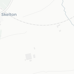
There are 9 schools within the typical catchment area, including 2 rated Outstanding by Ofsted and 5 rated Good. The nearest school is Old Farm School, about 5 minutes' walk away.

No crimes were reported on the surrounding streets in the most recent month, consistent with a very low local crime profile.

Healthcare access is good, with 3 GP surgeries, 1 hospital and 2 dental practices in the wider neighbourhood. The nearest GP practice is WE ARE WITH YOU REDCAR&CLEVELAND-LOFTUS, 1.3 mi away. The nearest hospital is EAST CLEVELAND HOSPITAL, 1.4 mi away. A pharmacy is 1.0 mi away.

There are no public transport stops near TS12 2TZ, making this a more car-dependent location.

The location is in Flood Zone 1 (low risk — less than a 1 in 1,000 annual chance of river or sea flooding).

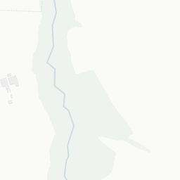
There are no mapped green spaces within walking distance of TS12 2TZ, though formal parks aren't the whole picture in more rural spots. It also lies just beside a nature reserve (about 5 minutes' walk away), adding open countryside that isn't recorded as a formal park.

There are 4 supermarkets in the wider area, including Morrisons, The Co-operative Group, Spar. The nearest is Morrisons Daily Loftus Zetland Road, 1.2 mi away. A public library is 1.2 mi away.

Sources: DfE/Ofsted, UK Police API, NHS ODS, NaPTAN, Environment Agency, Ordnance Survey, Natural England, DEFRA, Geolytix and Arts Council England. For an interactive map view, explore TS12 2TZ on NestScope.

Data: DfE/Ofsted · UK Police API · NHS ODS · NaPTAN · Ordnance Survey · Geolytix. Crown Copyright / OGL. Look up any postcode: nestscope.uk/area/YOUR+POSTCODE — e.g. SW1A 1AA, M1 1AE, BS1 1HT.

NestScope

All data from publicly available UK government sources. Each dimension uses a category-appropriate radius (walking distance for crime and transport, school catchment, drive distance for healthcare). IMD context is the latest published English Indices of Deprivation (2019). This report is for informational purposes only.