NestScope
SY6 6EX · Neighbourhood Report
© OpenStreetMap · © CARTO
Area Report
Last updated 17 JUN 2026

SY6 6EX

Neighbourhood Report

What's nearby — across walking, short-drive and school catchment distance. Data from official UK government sources.

NestScope Score
80/ 100

A well-off neighbourhood

Anchored on official IMD data — decile 8/10, ranked 25,331 of 32,844 neighbourhoods in England.

How this score is calculated
01 — Snapshot

Around SY6 6EX.

The large figure is how many we found nearby; the chip beside each label is that category’s NestScope score out of 100 — higher beats more of the UK.

Schools90/100
2Good/Outstanding within 1 mi

2 rated Good or better within 2 mi · 2 schools in total

Nearest top-rated: Church Stretton School (Good) — 0.0 mi

Safety96/100
0crimes last month

IMD crime decile 10/10 · no crimes in 400m last month

Crimes reported last month · UK Police API

Healthcare77/100
1GP & hospitals

IMD health decile 8/10 · 1 GP, 2 dentists, pharmacy 0.5 mi within 1.5 mi

Nearest GP: CHURCH STRETTON MEDICAL CENTRE — 0.5 mi

Transport55/100

No rail stations within 0.5 miles
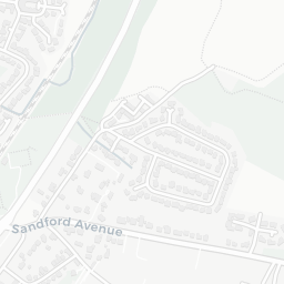
Green space79/100
7green spaces

IMD environment decile 6/10 · within AONB (11.8 ha total — largest park 3 ha (0.27 mi away))

Nearest: Sports Facility (3.0 ha) — 0.1 mi

Amenities69/100
2supermarkets

2 supermarkets within 2 mi — Midcounties Co-operative, Spar — nearest 0.5 mi — library 0.6 mi

Nearest: Co-op Church Stretton Food — 0.5 mi

02 — Environment

Environment & risk near SY6 6EX.

Official risk flags for context — deliberately not part of the NestScope score (they’re categorical hazards, not amenities).

Flood risk
Zone 3 (high)

Flood Zone 3 — high risk (1 in 100 annual chance) · Source: Environment Agency Flood Map for Planning

Zone 1
Zone 2
Zone 3
Air qualityWithin WHO guideline
3µg/m³

NO₂ annual mean · WHO guideline 10 · UK limit 40 · Source: DEFRA UK-AIR 2024

<10
10–20
20–30
30–40
≥40
Road noiseModerate
58dB Lden

Road traffic, day-evening-night average · Source: DEFRA strategic noise mapping

<55
55–64
65–74
≥75

About SY6 6EX

SY6 6EX scores 80/100 on the NestScope Score, with its strongest showing in safety and schools — with no crimes reported on the surrounding streets last month. The breakdown below draws on official UK data covering schools, safety, healthcare, transport, environment and local amenities.

Explore area insights about nearby locations

Data: DfE/Ofsted · UK Police API · NHS ODS · NaPTAN · Ordnance Survey · Geolytix. Crown Copyright / OGL. Look up any postcode: nestscope.uk/area/YOUR+POSTCODE — e.g. SW1A 1AA, M1 1AE, BS1 1HT.