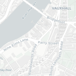
NestScope
SW8 4JS · Neighbourhood Report
© OpenStreetMap · © CARTO
Area Report
Last updated 12 JUN 2026

SW8 4JS

Neighbourhood Report

What's nearby — across walking, short-drive and school catchment distance. Data from official UK government sources.

NestScope Score
59/ 100

A mixed, mid-ranking neighbourhood

Anchored on official IMD data — decile 3/10, ranked 7,246 of 32,844 neighbourhoods in England.

How this score is calculated
01 — Snapshot

Around SW8 4JS.

The large figure is how many we found nearby; the chip beside each label is that category’s NestScope score out of 100 — higher beats more of the UK.

Safety64/100

IMD crime decile 6/10 · live count unavailable

Data temporarily unavailable

Healthcare77/100
58GP & hospitals

IMD health decile 4/10 · 55 GP, 3 hospitals, 58 dentists, pharmacy 0.3 mi within 1.5 mi

Nearest GP: SPRINGFIELD MEDICAL CENTRE — 0.5 mi

Transport79/100
Queenstown Road (Battersea) Rail Station0.3 mi
Battersea Park Rail Station0.3 mi
Wandsworth Road Rail Station0.5 mi
Battersea Power Station Underground Station0.2 mi

30 bus stops also within 0.5 miles

Green space65/100
27green spaces

IMD environment decile 5/10 · 8.6 ha total — no proper park nearby

Nearest: Sports Facility (400 m²) — 0.1 mi

Amenities92/100
121supermarkets

121 supermarkets within 2 mi — Sainsburys, Tesco, Marks and Spencer, Waitrose… — nearest 0.3 mi — library 0.7 mi

Nearest: Sainsburys Battersea Riverlight Local — 0.3 mi

02 — Environment

Environment & risk near SW8 4JS.

Official risk flags for context — deliberately not part of the NestScope score (they’re categorical hazards, not amenities).

Flood risk
Zone 3 (high)

Flood Zone 3 — high risk (1 in 100 annual chance) · Source: Environment Agency Flood Map for Planning

Zone 1
Zone 2
Zone 3
Air qualityModerate
21µg/m³

NO₂ annual mean · WHO guideline 10 · UK limit 40 · Source: DEFRA UK-AIR 2024

<10
10–20
20–30
30–40
≥40
Road noiseQuiet
50dB Lden

Road traffic, day-evening-night average · Source: DEFRA strategic noise mapping

<55
55–64
65–74
≥75
Rail noiseLoud
67dB Lden

Railways, day-evening-night average · Source: DEFRA strategic noise mapping

<55
55–64
65–74
≥75
03 — House prices

Sold prices in SW8.

Average sold price by property type across the SW8 district, 202120263,223 sales.

£0£2M£4M£6M£8M202120222023202420252026
  • Detached
  • Semi-detached
  • Terraced
  • Flat
Detached£7.8M 330.4%
Semi-detached£1.6M 63.7%
Terraced£962k 5.3%
Flat£565k 7.2%

District-level averages (SW8) — broad enough to show a reliable trend. A single postcode usually sees too few sales to chart. Source: HM Land Registry Price Paid Data (Crown Copyright / OGL v3.0).

About SW8 4JS

SW8 4JS scores 59/100 on the NestScope Score, with its strongest showing in local amenities and transport — with Sainsburys Battersea Riverlight Local about 6 minutes' walk away. The breakdown below draws on official UK data covering schools, safety, healthcare, transport, environment and local amenities.

In national context, SW8 4JS is a mixed, mid-ranking neighbourhood — IMD decile 3/10, ranked 7,246 of 32,844 neighbourhoods in England. The Index of Multiple Deprivation is the UK government's official measure of relative deprivation, refreshed roughly every five years. Housing pressure here is high (IMD housing decile 1/10).

There are 144 schools within the typical catchment area, including 24 rated Outstanding by Ofsted and 57 rated Good. The nearest school is St George's CofE Primary School (Ofsted: Good), within a short walk.

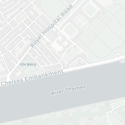
Healthcare access is good, with 55 GP surgeries, 3 hospitals and 58 dental practices in the wider neighbourhood. The nearest GP practice is SPRINGFIELD MEDICAL CENTRE, about 10 minutes' walk away. The nearest hospital is LISTER HOSPITAL, 0.8 mi away. A pharmacy is about 7 minutes' walk away.

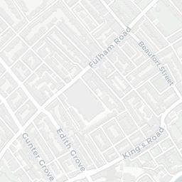
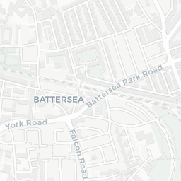
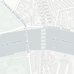
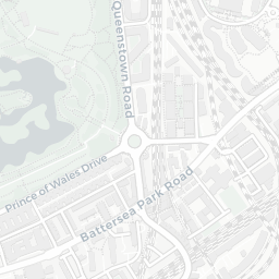
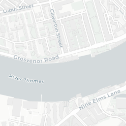
The nearest rail stations are Queenstown Road (Battersea) Rail Station (Train, about 7 minutes' walk away), Battersea Park Rail Station (Train, about 7 minutes' walk away), Wandsworth Road Rail Station (Train, about 10 minutes' walk away), Battersea Power Station Underground Station (Tube/Metro, about 5 minutes' walk away). There are also 30 bus stops within walking distance.

The location sits in Flood Zone 3 (high risk — between a 1 in 100 and 1 in 200 annual chance of river or sea flooding), which may affect insurance and mortgage availability. road traffic noise is low (about 50 dB Lden), and rail noise is high (about 67 dB Lden).

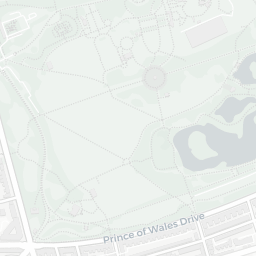
There are 27 green spaces within walking distance, totalling 8.6 hectares of parks and outdoor space. The nearest is Sports Facility (400 m²), within a short walk. It also lies just beside a nature reserve (about 8 minutes' walk away), adding open countryside that isn't recorded as a formal park.

There are 121 supermarkets in the wider area, including Sainsburys, Tesco, Marks and Spencer, Waitrose and others. The nearest is Sainsburys Battersea Riverlight Local, about 6 minutes' walk away. A public library is about 14 minutes' walk away.

Sources: DfE/Ofsted, UK Police API, NHS ODS, NaPTAN, Environment Agency, Ordnance Survey, Natural England, DEFRA, Geolytix and Arts Council England. For an interactive map view, explore SW8 4JS on NestScope.

Explore area insights about nearby locations

Data: DfE/Ofsted · UK Police API · NHS ODS · NaPTAN · Ordnance Survey · Geolytix. Crown Copyright / OGL. Look up any postcode: nestscope.uk/area/YOUR+POSTCODE — e.g. SW1A 1AA, M1 1AE, BS1 1HT.

NestScope

All data from publicly available UK government sources. Each dimension uses a category-appropriate radius (walking distance for crime and transport, school catchment, drive distance for healthcare). IMD context is the latest published English Indices of Deprivation (2019). This report is for informational purposes only.