Nearest top-rated: Oratory Roman Catholic Primary School (Outstanding) — 0.2 mi
Safety48/100
—
IMD crime decile 4/10 · live count unavailable
Data temporarily unavailable
Healthcare96/100
44GP & hospitals
IMD health decile 10/10 · 38 GP, 6 hospitals, 53 dentists, pharmacy 0.2 mi within 1.5 mi
Nearest GP: ROSARY GARDEN SURGERY — 0.4 mi
Transport96/100
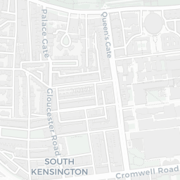
South Kensington Underground Station0.2 mi
South Kensington Underground Station0.2 mi
Gloucester Road Underground Station0.4 mi
48 bus stops also within 0.5 miles
Green space57/100
27green spaces
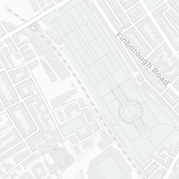
IMD environment decile 1/10 · 11.2 ha total — largest park 1 ha (0.22 mi away)
Nearest: Park (0.62 ha) — 0.1 mi
Amenities94/100
130supermarkets
130 supermarkets within 2 mi — Waitrose, Tesco, Marks and Spencer, Sainsburys… — nearest 0.2 mi — library 0.4 mi
Nearest: Little Waitrose Old Brompton Road — 0.2 mi
02 — Environment
Environment & risk near SW3 6RS.
Official risk flags for context — deliberately not part of the NestScope score (they’re categorical hazards, not amenities).
Flood risk
Zone 1 (low)
Flood Zone 1 — low risk (less than 1 in 1,000 annual chance) · Source: Environment Agency Flood Map for Planning
▼
Zone 1
Zone 2
Zone 3
Air qualityModerate
25.1µg/m³
NO₂ annual mean · WHO guideline 10 · UK limit 40 · Source: DEFRA UK-AIR 2024
▼
<10
10–20
20–30
30–40
≥40
03 — House prices
Sold prices in SW3.
Average sold price by property type across the SW3 district, 2021–2026 — 2,015 sales.
Detached
Semi-detached
Terraced
Flat
Detached£7.7M—
Semi-detached£12.8M▲ 95.0%
Terraced£3.4M▼ 26.3%
Flat£942k▼ 33.0%
District-level averages (SW3) — broad enough to show a reliable trend. A single postcode usually sees too few sales to chart. Source: HM Land Registry Price Paid Data (Crown Copyright / OGL v3.0).
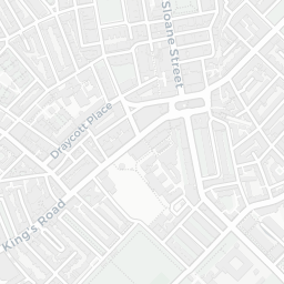
About SW3 6RS
SW3 6RS scores 77/100 on the NestScope Score, with its strongest showing in healthcare and transport — with ROSARY GARDEN SURGERY about 8 minutes' walk away. The breakdown below draws on official UK data covering schools, safety, healthcare, transport, environment and local amenities.
In national context, SW3 6RS is a well-off neighbourhood — IMD decile 7/10, ranked 21,201 of 32,844 neighbourhoods in England. The Index of Multiple Deprivation is the UK government's official measure of relative deprivation, refreshed roughly every five years. Housing pressure here is high (IMD housing decile 3/10).
There are 135 schools within the typical catchment area, including 19 rated Outstanding by Ofsted and 44 rated Good. The nearest school is Institute of Cancer Research, within a short walk.
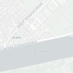
Healthcare access is good, with 38 GP surgeries, 6 hospitals and 53 dental practices in the wider neighbourhood. The nearest GP practice is ROSARY GARDEN SURGERY, about 8 minutes' walk away. The nearest hospital is THE ROYAL MARSDEN HOSPITAL, within a short walk. A pharmacy is about 4 minutes' walk away.
The nearest rail stations are South Kensington Underground Station (Tube/Metro, about 4 minutes' walk away), South Kensington Underground Station (Tube/Metro, about 5 minutes' walk away), Gloucester Road Underground Station (Tube/Metro, about 9 minutes' walk away). There are also 48 bus stops within walking distance.
The location is in Flood Zone 1 (low risk — less than a 1 in 1,000 annual chance of river or sea flooding).
There are 27 green spaces within walking distance, totalling 11.2 hectares of parks and outdoor space. The nearest is Park (0.62 ha), within a short walk.
There are 130 supermarkets in the wider area, including Waitrose, Tesco, Marks and Spencer, Sainsburys and others. The nearest is Little Waitrose Old Brompton Road, about 3 minutes' walk away. A public library is about 7 minutes' walk away.
Sources: DfE/Ofsted, UK Police API, NHS ODS, NaPTAN, Environment Agency, Ordnance Survey, Natural England, DEFRA, Geolytix and Arts Council England. For an interactive map view, explore SW3 6RS on NestScope.