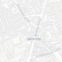
NestScope
SW2 1QS · Neighbourhood Report
© OpenStreetMap · © CARTO
Area Report
Last updated 15 JUN 2026

SW2 1QS

Neighbourhood Report

What's nearby — across walking, short-drive and school catchment distance. Data from official UK government sources.

NestScope Score
62/ 100

A mixed, mid-ranking neighbourhood

Anchored on official IMD data — decile 4/10, ranked 12,382 of 32,844 neighbourhoods in England.

How this score is calculated
01 — Snapshot

Around SW2 1QS.

The large figure is how many we found nearby; the chip beside each label is that category’s NestScope score out of 100 — higher beats more of the UK.

Schools87/100
25Good/Outstanding within 1 mi

85 rated Good or better within 2 mi · 128 schools in total

Nearest top-rated: Trinity Academy (Good) — 0.0 mi

Safety35/100
86crimes last month

IMD crime decile 2/10 · 86 crimes in 400m last month (residential-weighted: 55.9)

Crimes reported last month · UK Police API

Healthcare78/100
45GP & hospitals

IMD health decile 4/10 · 43 GP, 2 hospitals, 39 dentists, pharmacy 0.2 mi within 1.5 mi

Nearest GP: BRIXTON HILL GROUP PRACTICE — 0.3 mi

Transport91/100
Brixton Underground Station0.5 mi

32 bus stops also within 0.5 miles

Green space53/100
31green spaces

IMD environment decile 1/10 · 8.6 ha total — no proper park nearby

Nearest: Corpus Christi Roman Catholic Church — 0.0 mi

Amenities95/100
98supermarkets

98 supermarkets within 2 mi — Sainsburys, Tesco, Lidl, Iceland… — nearest 0.1 mi — library 0.4 mi

Nearest: Sainsburys Brixton Lambert Road Local — 0.1 mi

02 — Environment

Environment & risk near SW2 1QS.

Official risk flags for context — deliberately not part of the NestScope score (they’re categorical hazards, not amenities).

Flood risk
Zone 1 (low)

Flood Zone 1 — low risk (less than 1 in 1,000 annual chance) · Source: Environment Agency Flood Map for Planning

Zone 1
Zone 2
Zone 3
Air qualityLow
19.9µg/m³

NO₂ annual mean · WHO guideline 10 · UK limit 40 · Source: DEFRA UK-AIR 2024

<10
10–20
20–30
30–40
≥40
Road noiseModerate
55dB Lden

Road traffic, day-evening-night average · Source: DEFRA strategic noise mapping

<55
55–64
65–74
≥75
03 — House prices

Sold prices in SW2.

Average sold price by property type across the SW2 district, 202120263,941 sales.

£0£500k£1M£1.5M202120222023202420252026
  • Detached
  • Semi-detached
  • Terraced
  • Flat
Detached£1.3M 11.9%
Semi-detached£1.2M 14.9%
Terraced£795k 8.7%
Flat£447k 3.6%

District-level averages (SW2) — broad enough to show a reliable trend. A single postcode usually sees too few sales to chart. Source: HM Land Registry Price Paid Data (Crown Copyright / OGL v3.0).

About SW2 1QS

SW2 1QS scores 62/100 on the NestScope Score, with its strongest showing in local amenities and transport — with Sainsburys Brixton Lambert Road Local within a short walk. The main trade-off is its safety score. The breakdown below draws on official UK data covering schools, safety, healthcare, transport, environment and local amenities.

In national context, SW2 1QS is a mixed, mid-ranking neighbourhood — IMD decile 4/10, ranked 12,382 of 32,844 neighbourhoods in England. The Index of Multiple Deprivation is the UK government's official measure of relative deprivation, refreshed roughly every five years. Housing pressure here is high (IMD housing decile 4/10).

There are 128 schools within the typical catchment area, including 21 rated Outstanding by Ofsted and 64 rated Good. The nearest school is South Bank University Sixth Form, within a short walk.

There were 86 crimes reported on the surrounding streets in the most recent month, indicating a high level of immediate-area crime.

Healthcare access is good, with 43 GP surgeries, 2 hospitals and 39 dental practices in the wider neighbourhood. The nearest GP practice is BRIXTON HILL GROUP PRACTICE, about 6 minutes' walk away. The nearest hospital is THE LAMBETH HOSPITAL, about 12 minutes' walk away. A pharmacy is about 3 minutes' walk away.

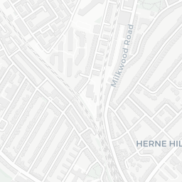
The nearest rail stations are Brixton Underground Station (Tube/Metro, about 9 minutes' walk away), Brixton Underground Station (Tube/Metro, about 10 minutes' walk away). There are also 32 bus stops within walking distance.

The location is in Flood Zone 1 (low risk — less than a 1 in 1,000 annual chance of river or sea flooding). road traffic noise is moderate (about 55 dB Lden).

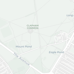
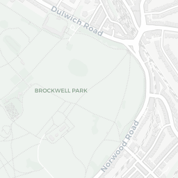
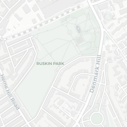
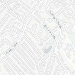
There are 31 green spaces within walking distance, totalling 8.6 hectares of parks and outdoor space. The nearest is Corpus Christi Roman Catholic Church, within a short walk.

There are 98 supermarkets in the wider area, including Sainsburys, Tesco, Lidl, Iceland and others. The nearest is Sainsburys Brixton Lambert Road Local, within a short walk. A public library is about 8 minutes' walk away.

Sources: DfE/Ofsted, UK Police API, NHS ODS, NaPTAN, Environment Agency, Ordnance Survey, Natural England, DEFRA, Geolytix and Arts Council England. For an interactive map view, explore SW2 1QS on NestScope.

Explore area insights about nearby locations

Data: DfE/Ofsted · UK Police API · NHS ODS · NaPTAN · Ordnance Survey · Geolytix. Crown Copyright / OGL. Look up any postcode: nestscope.uk/area/YOUR+POSTCODE — e.g. SW1A 1AA, M1 1AE, BS1 1HT.

NestScope

All data from publicly available UK government sources. Each dimension uses a category-appropriate radius (walking distance for crime and transport, school catchment, drive distance for healthcare). IMD context is the latest published English Indices of Deprivation (2019). This report is for informational purposes only.