NestScope
SW18 2PP · Neighbourhood Report
© OpenStreetMap · © CARTO
Area Report
Last updated 15 JUN 2026

SW18 2PP

Neighbourhood Report

What's nearby — across walking, short-drive and school catchment distance. Data from official UK government sources.

NestScope Score
64/ 100

An above-average neighbourhood

Anchored on official IMD data — decile 5/10, ranked 15,875 of 32,844 neighbourhoods in England.

How this score is calculated
01 — Snapshot

Around SW18 2PP.

The large figure is how many we found nearby; the chip beside each label is that category’s NestScope score out of 100 — higher beats more of the UK.

Schools75/100
12Good/Outstanding within 1 mi

69 rated Good or better within 2 mi · 114 schools in total

Nearest top-rated: Anglo Portuguese School of London (Good) — 0.0 mi

Safety45/100
81crimes last month

IMD crime decile 4/10 · 81 crimes in 400m last month (residential-weighted: 42.5)

Crimes reported last month · UK Police API

Healthcare82/100
51GP & hospitals

IMD health decile 6/10 · 50 GP, 1 hospital, 42 dentists, pharmacy 0.1 mi within 1.5 mi

Nearest GP: ELBOROUGH STREET SURGERY — 0.1 mi

Transport85/100
Wandsworth Town Rail Station0.3 mi

36 bus stops also within 0.5 miles

Green space71/100
21green spaces

IMD environment decile 4/10 · 31.1 ha total — largest park 19.8 ha (0.47 mi away)

Nearest: Garrat Lane Old Burial Ground — 0.1 mi

Amenities95/100
97supermarkets

97 supermarkets within 2 mi — Sainsburys, Lidl, Tesco, Waitrose… — nearest 0.1 mi — library 0.0 mi

Nearest: Sainsburys Wandsworth — 0.1 mi

02 — Environment

Environment & risk near SW18 2PP.

Official risk flags for context — deliberately not part of the NestScope score (they’re categorical hazards, not amenities).

Flood risk
Zone 1 (low)

Flood Zone 1 — low risk (less than 1 in 1,000 annual chance) · Source: Environment Agency Flood Map for Planning

Zone 1
Zone 2
Zone 3
Air qualityLow
19.2µg/m³

NO₂ annual mean · WHO guideline 10 · UK limit 40 · Source: DEFRA UK-AIR 2024

<10
10–20
20–30
30–40
≥40
03 — House prices

Sold prices in SW18.

Average sold price by property type across the SW18 district, 202120266,983 sales.

£0£1M£2M£3M202120222023202420252026
  • Detached
  • Semi-detached
  • Terraced
  • Flat
Detached£2.6M 10.1%
Semi-detached£1.7M 2.1%
Terraced£973k 12.6%
Flat£544k 0.7%

District-level averages (SW18) — broad enough to show a reliable trend. A single postcode usually sees too few sales to chart. Source: HM Land Registry Price Paid Data (Crown Copyright / OGL v3.0).

About SW18 2PP

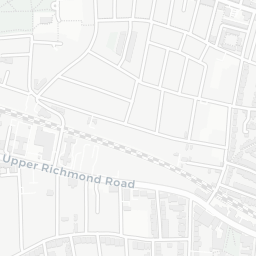
SW18 2PP scores 64/100 on the NestScope Score, with its strongest showing in local amenities and transport — with Sainsburys Wandsworth about 3 minutes' walk away. The breakdown below draws on official UK data covering schools, safety, healthcare, transport, environment and local amenities.

In national context, SW18 2PP is an above-average neighbourhood — IMD decile 5/10, ranked 15,875 of 32,844 neighbourhoods in England. The Index of Multiple Deprivation is the UK government's official measure of relative deprivation, refreshed roughly every five years. Housing pressure here is high (IMD housing decile 3/10).

There are 114 schools within the typical catchment area, including 19 rated Outstanding by Ofsted and 50 rated Good. The nearest school is Anglo Portuguese School of London (Ofsted: Good), within a short walk.

There were 81 crimes reported on the surrounding streets in the most recent month, indicating a high level of immediate-area crime.

Healthcare access is good, with 50 GP surgeries, 1 hospital and 42 dental practices in the wider neighbourhood. The nearest GP practice is ELBOROUGH STREET SURGERY, about 3 minutes' walk away. The nearest hospital is OLD HOSPITAL CLOSE, 1.5 mi away. A pharmacy is about 3 minutes' walk away.

The nearest rail stations are Wandsworth Town Rail Station (Train, about 7 minutes' walk away). There are also 36 bus stops within walking distance.

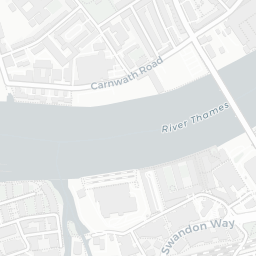
The location is in Flood Zone 1 (low risk — less than a 1 in 1,000 annual chance of river or sea flooding).

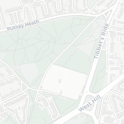
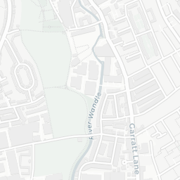
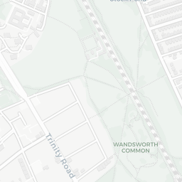
There are 21 green spaces within walking distance, totalling 31.1 hectares of parks and outdoor space. The nearest is Garrat Lane Old Burial Ground, within a short walk.

There are 97 supermarkets in the wider area, including Sainsburys, Lidl, Tesco, Waitrose and others. The nearest is Sainsburys Wandsworth, about 3 minutes' walk away. A public library is within a short walk.

Sources: DfE/Ofsted, UK Police API, NHS ODS, NaPTAN, Environment Agency, Ordnance Survey, Natural England, DEFRA, Geolytix and Arts Council England. For an interactive map view, explore SW18 2PP on NestScope.

Explore area insights about nearby locations

Data: DfE/Ofsted · UK Police API · NHS ODS · NaPTAN · Ordnance Survey · Geolytix. Crown Copyright / OGL. Look up any postcode: nestscope.uk/area/YOUR+POSTCODE — e.g. SW1A 1AA, M1 1AE, BS1 1HT.

NestScope

All data from publicly available UK government sources. Each dimension uses a category-appropriate radius (walking distance for crime and transport, school catchment, drive distance for healthcare). IMD context is the latest published English Indices of Deprivation (2019). This report is for informational purposes only.