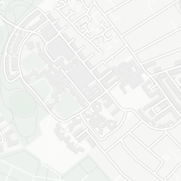
NestScope
SW17 0JA · Neighbourhood Report
© OpenStreetMap · © CARTO
Area Report
Last updated 13 JUN 2026

SW17 0JA

Neighbourhood Report

What's nearby — across walking, short-drive and school catchment distance. Data from official UK government sources.

NestScope Score
70/ 100

An above-average neighbourhood

Anchored on official IMD data — decile 6/10, ranked 16,536 of 32,844 neighbourhoods in England.

How this score is calculated
01 — Snapshot

Around SW17 0JA.

The large figure is how many we found nearby; the chip beside each label is that category’s NestScope score out of 100 — higher beats more of the UK.

Safety64/100
70crimes last month

IMD crime decile 8/10 · 70 crimes in 400m last month (residential-weighted: 53.8)

Crimes reported last month · UK Police API

Healthcare85/100
30GP & hospitals

IMD health decile 6/10 · 27 GP, 3 hospitals, 34 dentists, pharmacy 0.2 mi within 1.5 mi

Nearest GP: COMMUNITY SERVICES — 0.3 mi

Transport85/100
Tooting Broadway Underground Station0.4 mi

40 bus stops also within 0.5 miles

Green space75/100
18green spaces

IMD environment decile 4/10 · 47.4 ha total — largest park 20.7 ha (0.16 mi away)

Nearest: Tooting Gardens — 0.1 mi

Amenities92/100
79supermarkets

79 supermarkets within 2 mi — Marks and Spencer, Lidl, Sainsburys, Tesco… — nearest 0.3 mi — library 0.5 mi

Nearest: M&S St Georges Hosp SF — 0.3 mi

02 — Environment

Environment & risk near SW17 0JA.

Official risk flags for context — deliberately not part of the NestScope score (they’re categorical hazards, not amenities).

Flood risk
Zone 1 (low)

Flood Zone 1 — low risk (less than 1 in 1,000 annual chance) · Source: Environment Agency Flood Map for Planning

Zone 1
Zone 2
Zone 3
Air qualityLow
18.9µg/m³

NO₂ annual mean · WHO guideline 10 · UK limit 40 · Source: DEFRA UK-AIR 2024

<10
10–20
20–30
30–40
≥40
Road noiseQuiet
51dB Lden

Road traffic, day-evening-night average · Source: DEFRA strategic noise mapping

<55
55–64
65–74
≥75
03 — House prices

Sold prices in SW17.

Average sold price by property type across the SW17 district, 202120265,717 sales.

£0£1M£2M£3M202120222023202420252026
  • Detached
  • Semi-detached
  • Terraced
  • Flat
Detached£1.5M 22.5%
Semi-detached£1.2M 1.8%
Terraced£751k 15.0%
Flat£480k 1.4%

District-level averages (SW17) — broad enough to show a reliable trend. A single postcode usually sees too few sales to chart. Source: HM Land Registry Price Paid Data (Crown Copyright / OGL v3.0).

About SW17 0JA

SW17 0JA scores 70/100 on the NestScope Score, with its strongest showing in local amenities and healthcare — with M&S St Georges Hosp SF about 6 minutes' walk away. The breakdown below draws on official UK data covering schools, safety, healthcare, transport, environment and local amenities.

In national context, SW17 0JA is an above-average neighbourhood — IMD decile 6/10, ranked 16,536 of 32,844 neighbourhoods in England. The Index of Multiple Deprivation is the UK government's official measure of relative deprivation, refreshed roughly every five years. Housing pressure here is high (IMD housing decile 3/10).

There are 105 schools within the typical catchment area, including 22 rated Outstanding by Ofsted and 41 rated Good. The nearest school is Francis Barber Pupil Referral Unit, about 3 minutes' walk away.

There were 70 crimes reported on the surrounding streets in the most recent month, indicating a elevated level of immediate-area crime.

Healthcare access is good, with 27 GP surgeries, 3 hospitals and 34 dental practices in the wider neighbourhood. The nearest GP practice is COMMUNITY SERVICES, about 7 minutes' walk away. The nearest hospital is ST GEORGE'S HOSPITAL, about 5 minutes' walk away. A pharmacy is about 3 minutes' walk away.

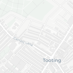
The nearest rail stations are Tooting Broadway Underground Station (Tube/Metro, about 8 minutes' walk away). There are also 40 bus stops within walking distance.

The location is in Flood Zone 1 (low risk — less than a 1 in 1,000 annual chance of river or sea flooding). road traffic noise is low (about 51 dB Lden).

There are 18 green spaces within walking distance, totalling 47.4 hectares of parks and outdoor space. The nearest is Tooting Gardens, about 2 minutes' walk away. It also lies just beside a nature reserve (about 9 minutes' walk away), adding open countryside that isn't recorded as a formal park.

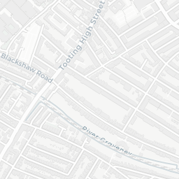
There are 79 supermarkets in the wider area, including Marks and Spencer, Lidl, Sainsburys, Tesco and others. The nearest is M&S St Georges Hosp SF, about 6 minutes' walk away. A public library is about 11 minutes' walk away.

Sources: DfE/Ofsted, UK Police API, NHS ODS, NaPTAN, Environment Agency, Ordnance Survey, Natural England, DEFRA, Geolytix and Arts Council England. For an interactive map view, explore SW17 0JA on NestScope.

Explore area insights about nearby locations

Data: DfE/Ofsted · UK Police API · NHS ODS · NaPTAN · Ordnance Survey · Geolytix. Crown Copyright / OGL. Look up any postcode: nestscope.uk/area/YOUR+POSTCODE — e.g. SW1A 1AA, M1 1AE, BS1 1HT.

NestScope

All data from publicly available UK government sources. Each dimension uses a category-appropriate radius (walking distance for crime and transport, school catchment, drive distance for healthcare). IMD context is the latest published English Indices of Deprivation (2019). This report is for informational purposes only.