NestScope
SW12 8NR · Neighbourhood Report
© OpenStreetMap · © CARTO
Area Report
Last updated 15 JUN 2026

SW12 8NR

Neighbourhood Report

What's nearby — across walking, short-drive and school catchment distance. Data from official UK government sources.

NestScope Score
78/ 100

A well-off neighbourhood

Anchored on official IMD data — decile 8/10, ranked 24,219 of 32,844 neighbourhoods in England.

How this score is calculated
01 — Snapshot

Around SW12 8NR.

The large figure is how many we found nearby; the chip beside each label is that category’s NestScope score out of 100 — higher beats more of the UK.

Schools86/100
17Good/Outstanding within 1 mi

71 rated Good or better within 2 mi · 120 schools in total

Nearest top-rated: Oak Lodge School (Good) — 0.1 mi

Safety54/100
27crimes last month

IMD crime decile 5/10 · 27 crimes in 400m last month (residential-weighted: 19.9)

Crimes reported last month · UK Police API

Healthcare91/100
26GP & hospitals

IMD health decile 9/10 · 24 GP, 2 hospitals, 39 dentists, pharmacy 0.3 mi within 1.5 mi

Nearest GP: BALHAM HEALTH CENTRE — 0.6 mi

Transport88/100
Wandsworth Common Rail Station0.3 mi

24 bus stops also within 0.5 miles

Green space66/100
5green spaces

IMD environment decile 3/10 · 64.9 ha total — no proper park nearby

Nearest: The Church of Jesus Christ of Latter-Day Saints — 0.2 mi

Amenities93/100
97supermarkets

97 supermarkets within 2 mi — Sainsburys, Waitrose, The Co-operative Group, Marks and Spencer… — nearest 0.3 mi — library 0.4 mi

Nearest: Sainsburys Balham Nightingale Lane Local — 0.3 mi

02 — Environment

Environment & risk near SW12 8NR.

Official risk flags for context — deliberately not part of the NestScope score (they’re categorical hazards, not amenities).

Flood risk
Zone 1 (low)

Flood Zone 1 — low risk (less than 1 in 1,000 annual chance) · Source: Environment Agency Flood Map for Planning

Zone 1
Zone 2
Zone 3
Air qualityLow
17.7µg/m³

NO₂ annual mean · WHO guideline 10 · UK limit 40 · Source: DEFRA UK-AIR 2024

<10
10–20
20–30
30–40
≥40
03 — House prices

Sold prices in SW12.

Average sold price by property type across the SW12 district, 202120263,236 sales.

£0£1M£2M£3M£4M202120222023202420252026
  • Detached
  • Semi-detached
  • Terraced
  • Flat
Detached£3.5M 47.3%
Semi-detached£1.7M 1.1%
Terraced£1.2M 0.3%
Flat£547k 6.8%

District-level averages (SW12) — broad enough to show a reliable trend. A single postcode usually sees too few sales to chart. Source: HM Land Registry Price Paid Data (Crown Copyright / OGL v3.0).

About SW12 8NR

SW12 8NR scores 78/100 on the NestScope Score, with its strongest showing in local amenities and healthcare — with Sainsburys Balham Nightingale Lane Local about 6 minutes' walk away. The breakdown below draws on official UK data covering schools, safety, healthcare, transport, environment and local amenities.

In national context, SW12 8NR is a well-off neighbourhood — IMD decile 8/10, ranked 24,219 of 32,844 neighbourhoods in England. The Index of Multiple Deprivation is the UK government's official measure of relative deprivation, refreshed roughly every five years. Housing pressure here is high (IMD housing decile 4/10).

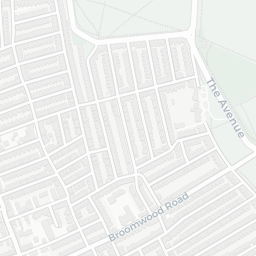
There are 120 schools within the typical catchment area, including 20 rated Outstanding by Ofsted and 51 rated Good. The nearest school is Broomwood Pre-Prep & Broomwood Prep-Girls, within a short walk.

There were 27 crimes reported on the surrounding streets in the most recent month, indicating a moderate level of immediate-area crime.

Healthcare access is good, with 24 GP surgeries, 2 hospitals and 39 dental practices in the wider neighbourhood. The nearest GP practice is BALHAM HEALTH CENTRE, about 12 minutes' walk away. The nearest hospital is OLD HOSPITAL CLOSE, about 11 minutes' walk away. A pharmacy is about 7 minutes' walk away.

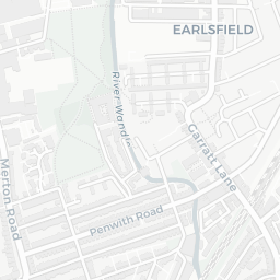
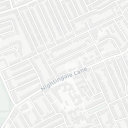
The nearest rail stations are Wandsworth Common Rail Station (Train, about 6 minutes' walk away). There are also 24 bus stops within walking distance.

The location is in Flood Zone 1 (low risk — less than a 1 in 1,000 annual chance of river or sea flooding).

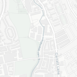
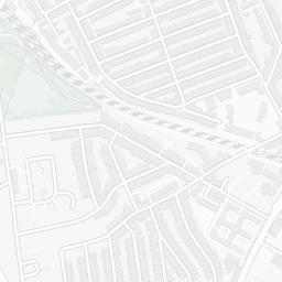
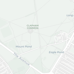
There are 5 green spaces within walking distance, totalling 64.9 hectares of parks and outdoor space. The nearest is The Church of Jesus Christ of Latter-Day Saints, about 4 minutes' walk away. It also lies just beside a nature reserve (about 11 minutes' walk away), adding open countryside that isn't recorded as a formal park.

There are 97 supermarkets in the wider area, including Sainsburys, Waitrose, The Co-operative Group, Marks and Spencer and others. The nearest is Sainsburys Balham Nightingale Lane Local, about 6 minutes' walk away. A public library is about 8 minutes' walk away.

Sources: DfE/Ofsted, UK Police API, NHS ODS, NaPTAN, Environment Agency, Ordnance Survey, Natural England, DEFRA, Geolytix and Arts Council England. For an interactive map view, explore SW12 8NR on NestScope.

Explore area insights about nearby locations

Data: DfE/Ofsted · UK Police API · NHS ODS · NaPTAN · Ordnance Survey · Geolytix. Crown Copyright / OGL. Look up any postcode: nestscope.uk/area/YOUR+POSTCODE — e.g. SW1A 1AA, M1 1AE, BS1 1HT.