NestScope
SK16 5LB · Neighbourhood Report
© OpenStreetMap · © CARTO
Area Report
Last updated 13 JUN 2026

SK16 5LB

Neighbourhood Report

What's nearby — across walking, short-drive and school catchment distance. Data from official UK government sources.

NestScope Score
62/ 100

A mixed, mid-ranking neighbourhood

Anchored on official IMD data — decile 4/10, ranked 12,995 of 32,844 neighbourhoods in England.

How this score is calculated
01 — Snapshot

Around SK16 5LB.

The large figure is how many we found nearby; the chip beside each label is that category’s NestScope score out of 100 — higher beats more of the UK.

Schools63/100
8Good/Outstanding within 1 mi

35 rated Good or better within 2 mi · 56 schools in total

Nearest top-rated: St. Mary's Catholic Primary School, a Voluntary Academy (Good) — 0.0 mi

Safety62/100
0crimes last month

IMD crime decile 3/10 · no crimes in 400m last month

Crimes reported last month · UK Police API

Healthcare70/100
13GP & hospitals

IMD health decile 3/10 · 13 GP, 10 dentists, pharmacy 0.1 mi within 1.5 mi

Nearest GP: DUKINFIELD MEDICAL PRACTICE — 0.6 mi

Transport81/100
Hyde North Rail Station0.4 mi
Flowery Field Rail Station0.5 mi

46 bus stops also within 0.5 miles

Green space72/100
13green spaces

IMD environment decile 5/10 · 30.4 ha total — largest park 6.9 ha (0.32 mi away)

Nearest: Astley Sports Village — 0.2 mi

Amenities80/100
25supermarkets

25 supermarkets within 2 mi — Morrisons, The Co-operative Group, Iceland, Farmfoods… — nearest 0.4 mi — library 0.6 mi

Nearest: Morrisons Daily Hyde Ashton Road — 0.4 mi

02 — Environment

Environment & risk near SK16 5LB.

Official risk flags for context — deliberately not part of the NestScope score (they’re categorical hazards, not amenities).

Flood risk
Zone 1 (low)

Flood Zone 1 — low risk (less than 1 in 1,000 annual chance) · Source: Environment Agency Flood Map for Planning

Zone 1
Zone 2
Zone 3
Air qualityLow
12.9µg/m³

NO₂ annual mean · WHO guideline 10 · UK limit 40 · Source: DEFRA UK-AIR 2024

<10
10–20
20–30
30–40
≥40
Road noiseLoud
65dB Lden

Road traffic, day-evening-night average · Source: DEFRA strategic noise mapping

<55
55–64
65–74
≥75

About SK16 5LB

SK16 5LB scores 62/100 on the NestScope Score, with its strongest showing in transport and local amenities — with Hyde North Rail Station about 9 minutes' walk away. The breakdown below draws on official UK data covering schools, safety, healthcare, transport, environment and local amenities.

In national context, SK16 5LB is a mixed, mid-ranking neighbourhood — IMD decile 4/10, ranked 12,995 of 32,844 neighbourhoods in England. The Index of Multiple Deprivation is the UK government's official measure of relative deprivation, refreshed roughly every five years. Housing pressure here is low (IMD housing decile 9/10).

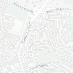
There are 56 schools within the typical catchment area, including 35 rated Good. The nearest school is St. Mary's Catholic Primary School, a Voluntary Academy (Ofsted: Good), within a short walk.

No crimes were reported on the surrounding streets in the most recent month, consistent with a very low local crime profile.

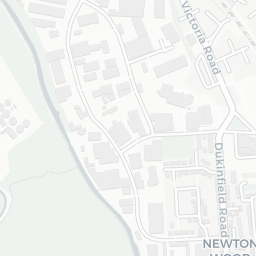
Healthcare access is good, with 13 GP surgeries and 10 dental practices in the wider neighbourhood. The nearest GP practice is DUKINFIELD MEDICAL PRACTICE, about 13 minutes' walk away. A pharmacy is about 3 minutes' walk away.

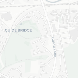
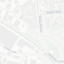
The nearest rail stations are Hyde North Rail Station (Train, about 9 minutes' walk away), Flowery Field Rail Station (Train, about 10 minutes' walk away). There are also 46 bus stops within walking distance.

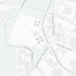
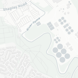
The location is in Flood Zone 1 (low risk — less than a 1 in 1,000 annual chance of river or sea flooding). road traffic noise is high (about 65 dB Lden).

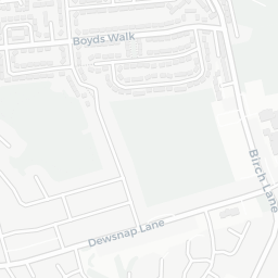
There are 13 green spaces within walking distance, totalling 30.4 hectares of parks and outdoor space. The nearest is Astley Sports Village, about 4 minutes' walk away.

There are 25 supermarkets in the wider area, including Morrisons, The Co-operative Group, Iceland, Farmfoods and others. The nearest is Morrisons Daily Hyde Ashton Road, about 8 minutes' walk away. A public library is about 13 minutes' walk away.

Sources: DfE/Ofsted, UK Police API, NHS ODS, NaPTAN, Environment Agency, Ordnance Survey, Natural England, DEFRA, Geolytix and Arts Council England. For an interactive map view, explore SK16 5LB on NestScope.

Explore area insights about nearby locations

Data: DfE/Ofsted · UK Police API · NHS ODS · NaPTAN · Ordnance Survey · Geolytix. Crown Copyright / OGL. Look up any postcode: nestscope.uk/area/YOUR+POSTCODE — e.g. SW1A 1AA, M1 1AE, BS1 1HT.

NestScope

All data from publicly available UK government sources. Each dimension uses a category-appropriate radius (walking distance for crime and transport, school catchment, drive distance for healthcare). IMD context is the latest published English Indices of Deprivation (2019). This report is for informational purposes only.