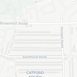
NestScope
SE6 2LD · Neighbourhood Report
© OpenStreetMap · © CARTO
Area Report
Last updated 15 JUN 2026

SE6 2LD

Neighbourhood Report

What's nearby — across walking, short-drive and school catchment distance. Data from official UK government sources.

NestScope Score
61/ 100

A mixed, mid-ranking neighbourhood

Anchored on official IMD data — decile 4/10, ranked 12,238 of 32,844 neighbourhoods in England.

How this score is calculated
01 — Snapshot

Around SE6 2LD.

The large figure is how many we found nearby; the chip beside each label is that category’s NestScope score out of 100 — higher beats more of the UK.

Schools75/100
12Good/Outstanding within 1 mi

61 rated Good or better within 2 mi · 83 schools in total

Nearest top-rated: Holy Cross Catholic Primary School (Outstanding) — 0.0 mi

Safety45/100
83crimes last month

IMD crime decile 4/10 · 83 crimes in 400m last month (residential-weighted: 51.2)

Crimes reported last month · UK Police API

Healthcare81/100
27GP & hospitals

IMD health decile 5/10 · 26 GP, 1 hospital, 22 dentists, pharmacy 0.2 mi within 1.5 mi

Nearest GP: OHL WEIGHT MANAGEMENT CLINIC — 0.2 mi

Transport81/100
Catford Bridge Rail Station0.4 mi
Catford Rail Station0.4 mi

37 bus stops also within 0.5 miles

Green space65/100
7green spaces

IMD environment decile 3/10 · 23.5 ha total — no proper park nearby

Nearest: Allotments (0.43 ha) — 0.2 mi

Amenities95/100
53supermarkets

53 supermarkets within 2 mi — Lidl, The Co-operative Group, Iceland, Tesco… — nearest 0.1 mi — library 0.3 mi

Nearest: Lidl Catford London — 0.1 mi

02 — Environment

Environment & risk near SE6 2LD.

Official risk flags for context — deliberately not part of the NestScope score (they’re categorical hazards, not amenities).

Flood risk
Zone 1 (low)

Flood Zone 1 — low risk (less than 1 in 1,000 annual chance) · Source: Environment Agency Flood Map for Planning

Zone 1
Zone 2
Zone 3
Air qualityLow
18.2µg/m³

NO₂ annual mean · WHO guideline 10 · UK limit 40 · Source: DEFRA UK-AIR 2024

<10
10–20
20–30
30–40
≥40
Road noiseQuiet
52dB Lden

Road traffic, day-evening-night average · Source: DEFRA strategic noise mapping

<55
55–64
65–74
≥75
Rail noiseQuiet
45dB Lden

Railways, day-evening-night average · Source: DEFRA strategic noise mapping

<55
55–64
65–74
≥75

About SE6 2LD

SE6 2LD scores 61/100 on the NestScope Score, with its strongest showing in local amenities and healthcare — with Lidl Catford London about 3 minutes' walk away. The breakdown below draws on official UK data covering schools, safety, healthcare, transport, environment and local amenities.

In national context, SE6 2LD is a mixed, mid-ranking neighbourhood — IMD decile 4/10, ranked 12,238 of 32,844 neighbourhoods in England. The Index of Multiple Deprivation is the UK government's official measure of relative deprivation, refreshed roughly every five years. Housing pressure here is high (IMD housing decile 2/10).

There are 83 schools within the typical catchment area, including 13 rated Outstanding by Ofsted and 48 rated Good. The nearest school is Holy Cross Catholic Primary School (Ofsted: Outstanding), within a short walk.

There were 83 crimes reported on the surrounding streets in the most recent month, indicating a high level of immediate-area crime.

Healthcare access is good, with 26 GP surgeries, 1 hospital and 22 dental practices in the wider neighbourhood. The nearest GP practice is OHL WEIGHT MANAGEMENT CLINIC, about 4 minutes' walk away. The nearest hospital is UNIVERSITY HOSPITAL LEWISHAM, 0.8 mi away. A pharmacy is about 4 minutes' walk away.

The nearest rail stations are Catford Bridge Rail Station (Train, about 7 minutes' walk away), Catford Rail Station (Train, about 8 minutes' walk away). There are also 37 bus stops within walking distance.

The location is in Flood Zone 1 (low risk — less than a 1 in 1,000 annual chance of river or sea flooding). road traffic noise is low (about 52 dB Lden), and rail noise is low (about 45 dB Lden).

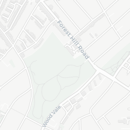
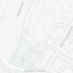
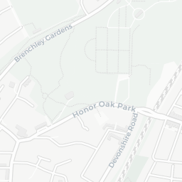
There are 7 green spaces within walking distance, totalling 23.5 hectares of parks and outdoor space. The nearest is Allotments (0.43 ha), about 4 minutes' walk away.

There are 53 supermarkets in the wider area, including Lidl, The Co-operative Group, Iceland, Tesco and others. The nearest is Lidl Catford London, about 3 minutes' walk away. A public library is about 6 minutes' walk away.

Sources: DfE/Ofsted, UK Police API, NHS ODS, NaPTAN, Environment Agency, Ordnance Survey, Natural England, DEFRA, Geolytix and Arts Council England. For an interactive map view, explore SE6 2LD on NestScope.

Explore area insights about nearby locations

Data: DfE/Ofsted · UK Police API · NHS ODS · NaPTAN · Ordnance Survey · Geolytix. Crown Copyright / OGL. Look up any postcode: nestscope.uk/area/YOUR+POSTCODE — e.g. SW1A 1AA, M1 1AE, BS1 1HT.

NestScope

All data from publicly available UK government sources. Each dimension uses a category-appropriate radius (walking distance for crime and transport, school catchment, drive distance for healthcare). IMD context is the latest published English Indices of Deprivation (2019). This report is for informational purposes only.