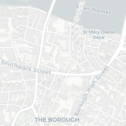
NestScope
SE1 0RF · Neighbourhood Report
© OpenStreetMap · © CARTO
Area Report
Last updated 12 JUN 2026

SE1 0RF

Neighbourhood Report

What's nearby — across walking, short-drive and school catchment distance. Data from official UK government sources.

NestScope Score
60/ 100

A mixed, mid-ranking neighbourhood

Anchored on official IMD data — decile 3/10, ranked 7,940 of 32,844 neighbourhoods in England.

How this score is calculated
01 — Snapshot

Around SE1 0RF.

The large figure is how many we found nearby; the chip beside each label is that category’s NestScope score out of 100 — higher beats more of the UK.

Safety54/100
161crimes last month

IMD crime decile 6/10 · 161 crimes in 400m last month (residential-weighted: 97.4)

Crimes reported last month · UK Police API

Healthcare75/100
77GP & hospitals

IMD health decile 3/10 · 72 GP, 5 hospitals, 79 dentists, pharmacy 0.3 mi within 1.5 mi

Nearest GP: LAS S.E. LONDON IUC CAS — 0.3 mi

Transport79/100
London Waterloo East Rail Station0.3 mi
London Waterloo Rail Station0.5 mi
Southwark Underground Station0.2 mi
Southwark Underground Station0.3 mi
Elephant & Castle Underground Station0.4 mi

68 bus stops also within 0.5 miles

Green space57/100
40green spaces

IMD environment decile 1/10 · 14.2 ha total — no proper park nearby

Nearest: Playground (200 m²) — 0.1 mi

Amenities91/100
198supermarkets

198 supermarkets within 2 mi — Sainsburys, Tesco, The Co-operative Group, Marks and Spencer… — nearest 0.1 mi — library 0.4 mi

Nearest: Sainsburys Waterloo Blackfriars Road Local — 0.1 mi

02 — Environment

Environment & risk near SE1 0RF.

Official risk flags for context — deliberately not part of the NestScope score (they’re categorical hazards, not amenities).

Flood risk
Zone 3 (high)

Flood Zone 3 — high risk (1 in 100 annual chance) · Source: Environment Agency Flood Map for Planning

Zone 1
Zone 2
Zone 3
Air qualityModerate
29.3µg/m³

NO₂ annual mean · WHO guideline 10 · UK limit 40 · Source: DEFRA UK-AIR 2024

<10
10–20
20–30
30–40
≥40
Road noiseModerate
55dB Lden

Road traffic, day-evening-night average · Source: DEFRA strategic noise mapping

<55
55–64
65–74
≥75
Rail noiseQuiet
53dB Lden

Railways, day-evening-night average · Source: DEFRA strategic noise mapping

<55
55–64
65–74
≥75
03 — House prices

Sold prices in SE1.

Average sold price by property type across the SE1 district, 202120264,704 sales.

£0£1M£2M£3M202120222023202420252026
  • Detached
  • Semi-detached
  • Terraced
  • Flat
Detached
Semi-detached£1.0M 29.4%
Terraced£678k 34.2%
Flat£593k 35.8%

District-level averages (SE1) — broad enough to show a reliable trend. A single postcode usually sees too few sales to chart. Source: HM Land Registry Price Paid Data (Crown Copyright / OGL v3.0).

About SE1 0RF

SE1 0RF scores 60/100 on the NestScope Score, with its strongest showing in local amenities and schools — with Sainsburys Waterloo Blackfriars Road Local within a short walk. The breakdown below draws on official UK data covering schools, safety, healthcare, transport, environment and local amenities.

In national context, SE1 0RF is a mixed, mid-ranking neighbourhood — IMD decile 3/10, ranked 7,940 of 32,844 neighbourhoods in England. The Index of Multiple Deprivation is the UK government's official measure of relative deprivation, refreshed roughly every five years. Housing pressure here is high (IMD housing decile 2/10).

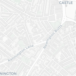
There are 167 schools within the typical catchment area, including 25 rated Outstanding by Ofsted and 60 rated Good. The nearest school is Friars Primary Foundation School (Ofsted: Good), within a short walk.

There were 161 crimes reported on the surrounding streets in the most recent month, indicating a high level of immediate-area crime.

Healthcare access is good, with 72 GP surgeries, 5 hospitals and 79 dental practices in the wider neighbourhood. The nearest GP practice is LAS S.E. LONDON IUC CAS, about 5 minutes' walk away. The nearest hospital is ST THOMAS' HOSPITAL, 0.7 mi away. A pharmacy is about 6 minutes' walk away.

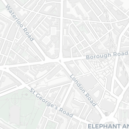
The nearest rail stations are London Waterloo East Rail Station (Train, about 7 minutes' walk away), London Waterloo Rail Station (Train, about 9 minutes' walk away), Southwark Underground Station (Tube/Metro, about 5 minutes' walk away), Southwark Underground Station (Tube/Metro, about 5 minutes' walk away), Elephant & Castle Underground Station (Tube/Metro, about 7 minutes' walk away). There are also 68 bus stops within walking distance.

The location sits in Flood Zone 3 (high risk — between a 1 in 100 and 1 in 200 annual chance of river or sea flooding), which may affect insurance and mortgage availability. road traffic noise is moderate (about 55 dB Lden), and rail noise is low (about 53 dB Lden).

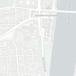
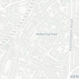
There are 40 green spaces within walking distance, totalling 14.2 hectares of parks and outdoor space. The nearest is Playground (200 m²), within a short walk.

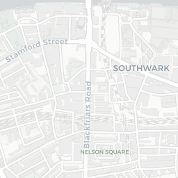
There are 198 supermarkets in the wider area, including Sainsburys, Tesco, The Co-operative Group, Marks and Spencer and others. The nearest is Sainsburys Waterloo Blackfriars Road Local, within a short walk. A public library is about 9 minutes' walk away.

Sources: DfE/Ofsted, UK Police API, NHS ODS, NaPTAN, Environment Agency, Ordnance Survey, Natural England, DEFRA, Geolytix and Arts Council England. For an interactive map view, explore SE1 0RF on NestScope.

Explore area insights about nearby locations

Data: DfE/Ofsted · UK Police API · NHS ODS · NaPTAN · Ordnance Survey · Geolytix. Crown Copyright / OGL. Look up any postcode: nestscope.uk/area/YOUR+POSTCODE — e.g. SW1A 1AA, M1 1AE, BS1 1HT.

NestScope

All data from publicly available UK government sources. Each dimension uses a category-appropriate radius (walking distance for crime and transport, school catchment, drive distance for healthcare). IMD context is the latest published English Indices of Deprivation (2019). This report is for informational purposes only.