NestScope
NW6 6TN · Neighbourhood Report
© OpenStreetMap · © CARTO
Area Report
Last updated 12 JUN 2026

NW6 6TN

Neighbourhood Report

What's nearby — across walking, short-drive and school catchment distance. Data from official UK government sources.

NestScope Score
63/ 100

An above-average neighbourhood

Anchored on official IMD data — decile 5/10, ranked 14,258 of 32,844 neighbourhoods in England.

How this score is calculated
01 — Snapshot

Around NW6 6TN.

The large figure is how many we found nearby; the chip beside each label is that category’s NestScope score out of 100 — higher beats more of the UK.

Schools86/100
30Good/Outstanding within 1 mi

94 rated Good or better within 2 mi · 152 schools in total

Nearest top-rated: Islamia Primary School (Good) — 0.1 mi

Safety32/100

IMD crime decile 2/10 · live count unavailable

Data temporarily unavailable

Healthcare92/100
57GP & hospitals

IMD health decile 9/10 · 54 GP, 3 hospitals, 55 dentists, pharmacy 0.2 mi within 1.5 mi

Nearest GP: THE LONSDALE MEDICAL CENTRE — 0.3 mi

Transport84/100
Brondesbury Park Rail Station0.1 mi
Queens Park (London) Rail Station0.4 mi
Queen's Park Underground Station0.4 mi

19 bus stops also within 0.5 miles

Green space64/100
7green spaces

IMD environment decile 3/10 · 22.8 ha total — no proper park nearby

Nearest: Paddington Cemetery — 0.2 mi

Amenities94/100
72supermarkets

72 supermarkets within 2 mi — Planet Organic, Sainsburys, The Co-operative Group, Tesco… — nearest 0.2 mi — library 0.3 mi

Nearest: Planet Organic Queen's Park — 0.2 mi

02 — Environment

Environment & risk near NW6 6TN.

Official risk flags for context — deliberately not part of the NestScope score (they’re categorical hazards, not amenities).

Flood risk
Zone 1 (low)

Flood Zone 1 — low risk (less than 1 in 1,000 annual chance) · Source: Environment Agency Flood Map for Planning

Zone 1
Zone 2
Zone 3
Air qualityLow
19.4µg/m³

NO₂ annual mean · WHO guideline 10 · UK limit 40 · Source: DEFRA UK-AIR 2024

<10
10–20
20–30
30–40
≥40
Road noiseModerate
59dB Lden

Road traffic, day-evening-night average · Source: DEFRA strategic noise mapping

<55
55–64
65–74
≥75
03 — House prices

Sold prices in NW6.

Average sold price by property type across the NW6 district, 202120264,329 sales.

£0£1M£2M£3M£4M202120222023202420252026
  • Detached
  • Semi-detached
  • Terraced
  • Flat
Detached£2.9M 22.4%
Semi-detached£2.5M 21.2%
Terraced£1.6M 1.7%
Flat£678k 2.1%

District-level averages (NW6) — broad enough to show a reliable trend. A single postcode usually sees too few sales to chart. Source: HM Land Registry Price Paid Data (Crown Copyright / OGL v3.0).

About NW6 6TN

NW6 6TN scores 63/100 on the NestScope Score, with its strongest showing in local amenities and healthcare — with Planet Organic Queen's Park about 4 minutes' walk away. The main trade-off is its safety score. The breakdown below draws on official UK data covering schools, safety, healthcare, transport, environment and local amenities.

In national context, NW6 6TN is an above-average neighbourhood — IMD decile 5/10, ranked 14,258 of 32,844 neighbourhoods in England. The Index of Multiple Deprivation is the UK government's official measure of relative deprivation, refreshed roughly every five years. Housing pressure here is high (IMD housing decile 3/10).

There are 152 schools within the typical catchment area, including 23 rated Outstanding by Ofsted and 71 rated Good. The nearest school is Al-Sadiq School, within a short walk.

Healthcare access is good, with 54 GP surgeries, 3 hospitals and 55 dental practices in the wider neighbourhood. The nearest GP practice is THE LONSDALE MEDICAL CENTRE, about 6 minutes' walk away. The nearest hospital is FORDWYCH ROAD DAY HOSPITAL, 0.8 mi away. A pharmacy is about 5 minutes' walk away.

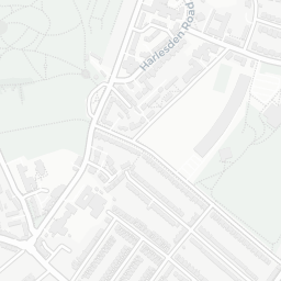
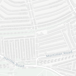
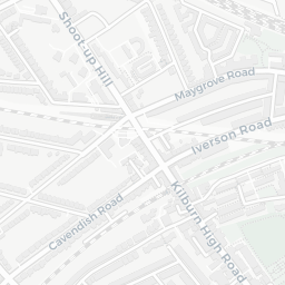
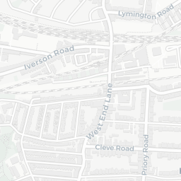
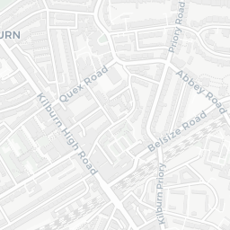
The nearest rail stations are Brondesbury Park Rail Station (Train, within a short walk), Queens Park (London) Rail Station (Train, about 9 minutes' walk away), Queen's Park Underground Station (Tube/Metro, about 9 minutes' walk away). There are also 19 bus stops within walking distance.

The location is in Flood Zone 1 (low risk — less than a 1 in 1,000 annual chance of river or sea flooding). road traffic noise is moderate (about 59 dB Lden).

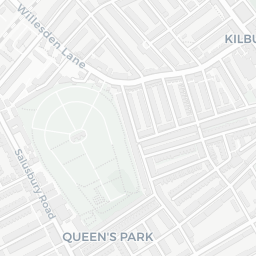
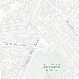
There are 7 green spaces within walking distance, totalling 22.8 hectares of parks and outdoor space. The nearest is Paddington Cemetery, about 4 minutes' walk away. It also lies just beside a nature reserve (0.9 mi away), adding open countryside that isn't recorded as a formal park.

There are 72 supermarkets in the wider area, including Planet Organic, Sainsburys, The Co-operative Group, Tesco and others. The nearest is Planet Organic Queen's Park, about 4 minutes' walk away. A public library is about 7 minutes' walk away.

Sources: DfE/Ofsted, UK Police API, NHS ODS, NaPTAN, Environment Agency, Ordnance Survey, Natural England, DEFRA, Geolytix and Arts Council England. For an interactive map view, explore NW6 6TN on NestScope.

Explore area insights about nearby locations

Data: DfE/Ofsted · UK Police API · NHS ODS · NaPTAN · Ordnance Survey · Geolytix. Crown Copyright / OGL. Look up any postcode: nestscope.uk/area/YOUR+POSTCODE — e.g. SW1A 1AA, M1 1AE, BS1 1HT.

NestScope

All data from publicly available UK government sources. Each dimension uses a category-appropriate radius (walking distance for crime and transport, school catchment, drive distance for healthcare). IMD context is the latest published English Indices of Deprivation (2019). This report is for informational purposes only.