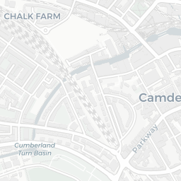
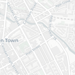
NestScope
NW1 0NH · Neighbourhood Report
© OpenStreetMap · © CARTO
Area Report
Last updated 16 JUN 2026

NW1 0NH

Neighbourhood Report

What's nearby — across walking, short-drive and school catchment distance. Data from official UK government sources.

NestScope Score
60/ 100

A mixed, mid-ranking neighbourhood

Anchored on official IMD data — decile 4/10, ranked 11,047 of 32,844 neighbourhoods in England.

How this score is calculated
01 — Snapshot

Around NW1 0NH.

The large figure is how many we found nearby; the chip beside each label is that category’s NestScope score out of 100 — higher beats more of the UK.

Schools71/100
29Good/Outstanding within 1 mi

94 rated Good or better within 2 mi · 162 schools in total

Nearest top-rated: Regent High School (Good) — 0.1 mi

Safety50/100
117crimes last month

IMD crime decile 5/10 · 117 crimes in 400m last month (residential-weighted: 80.2)

Crimes reported last month · UK Police API

Healthcare76/100
84GP & hospitals

IMD health decile 3/10 · 67 GP, 17 hospitals, 101 dentists, pharmacy 0.3 mi within 1.5 mi

Nearest GP: AMPTHILL & REGENTS PARK PRACTICE — 0.1 mi

Transport82/100
London St Pancras International Rail Station0.4 mi
London St Pancras International LL Rail Station0.4 mi
London St Pancras International Rail Station0.4 mi
Mornington Crescent Underground Station0.3 mi
Camden Town Underground Station0.4 mi

45 bus stops also within 0.5 miles

Green space61/100
32green spaces

IMD environment decile 4/10 · beside nature reserve (7.9 ha total — no proper park nearby)

Nearest: Goldington Crescent Gardens — 0.1 mi

Amenities95/100
161supermarkets

161 supermarkets within 2 mi — The Co-operative Group, Sainsburys, Aldi, Marks and Spencer… — nearest 0.2 mi — library 0.2 mi

Nearest: Co-op Camden - Camley Street — 0.2 mi

02 — Environment

Environment & risk near NW1 0NH.

Official risk flags for context — deliberately not part of the NestScope score (they’re categorical hazards, not amenities).

Flood risk
Zone 1 (low)

Flood Zone 1 — low risk (less than 1 in 1,000 annual chance) · Source: Environment Agency Flood Map for Planning

Zone 1
Zone 2
Zone 3
Air qualityModerate
26.5µg/m³

NO₂ annual mean · WHO guideline 10 · UK limit 40 · Source: DEFRA UK-AIR 2024

<10
10–20
20–30
30–40
≥40
Road noiseLoud
66dB Lden

Road traffic, day-evening-night average · Source: DEFRA strategic noise mapping

<55
55–64
65–74
≥75
Rail noiseQuiet
45dB Lden

Railways, day-evening-night average · Source: DEFRA strategic noise mapping

<55
55–64
65–74
≥75
03 — House prices

Sold prices in NW1.

Average sold price by property type across the NW1 district, 202120262,705 sales.

£0£5M£10M£15M202120222023202420252026
  • Detached
  • Semi-detached
  • Terraced
  • Flat
Detached£6.3M 2.1%
Semi-detached£2.0M 18.7%
Terraced£1.4M 44.7%
Flat£640k 28.5%

District-level averages (NW1) — broad enough to show a reliable trend. A single postcode usually sees too few sales to chart. Source: HM Land Registry Price Paid Data (Crown Copyright / OGL v3.0).

About NW1 0NH

NW1 0NH scores 60/100 on the NestScope Score, with its strongest showing in local amenities and transport — with Co-op Camden - Camley Street about 3 minutes' walk away. The breakdown below draws on official UK data covering schools, safety, healthcare, transport, environment and local amenities.

Explore area insights about nearby locations

Data: DfE/Ofsted · UK Police API · NHS ODS · NaPTAN · Ordnance Survey · Geolytix. Crown Copyright / OGL. Look up any postcode: nestscope.uk/area/YOUR+POSTCODE — e.g. SW1A 1AA, M1 1AE, BS1 1HT.