
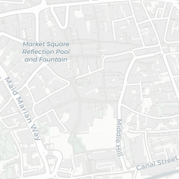
About NG1 5AW
NG1 5AW scores 80/100 on the NestScope Score, with its strongest showing in transport and local amenities — with NTU Tram Stop about 5 minutes' walk away. The breakdown below draws on official UK data covering schools, safety, healthcare, transport, environment and local amenities.
In national context, NG1 5AW is one of the most affluent neighbourhoods in England — IMD decile 9/10, ranked 27,218 of 32,844 neighbourhoods in England. The Index of Multiple Deprivation is the UK government's official measure of relative deprivation, refreshed roughly every five years. Housing pressure here is moderate (IMD housing decile 6/10).
There are 66 schools within the typical catchment area, including 2 rated Outstanding by Ofsted and 41 rated Good. The nearest school is St Joseph's School, within a short walk.
There were 115 crimes reported on the surrounding streets in the most recent month, indicating a high level of immediate-area crime.
Healthcare access is good, with 29 GP surgeries, 3 hospitals and 27 dental practices in the wider neighbourhood. The nearest GP practice is NC GPA PLUS, about 5 minutes' walk away. The nearest hospital is NOTTINGHAM UNIVERSITY HOSPITALS NHS TRUST - ROPEWALK HOUSE, within a short walk. A pharmacy is about 10 minutes' walk away.
The nearest rail stations are NTU Tram Stop (Tube/Metro, about 5 minutes' walk away), NTU Tram Stop (Tube/Metro, about 5 minutes' walk away), Royal Centre Tram Stop (Tube/Metro, about 6 minutes' walk away). There are also 61 bus stops within walking distance.
The location is in Flood Zone 1 (low risk — less than a 1 in 1,000 annual chance of river or sea flooding). road traffic noise is high (about 68 dB Lden).
There are 16 green spaces within walking distance, totalling 18.4 hectares of parks and outdoor space. The nearest is St Barnabas Roman Catholic Cathedral, within a short walk.
There are 56 supermarkets in the wider area, including The Co-operative Group, Tesco, Waitrose, Sainsburys and others. The nearest is Co-op University of Nottingham Trent, about 5 minutes' walk away. A public library is about 12 minutes' walk away.
Sources: DfE/Ofsted, UK Police API, NHS ODS, NaPTAN, Environment Agency, Ordnance Survey, Natural England, DEFRA, Geolytix and Arts Council England. For an interactive map view, explore NG1 5AW on NestScope.