NestScope
LL41 4RT · Neighbourhood Report
© OpenStreetMap · © CARTO
Area Report
Last updated 16 JUN 2026

LL41 4RT

Neighbourhood Report

What's nearby — across walking, short-drive and school catchment distance. Data from official UK government sources.

NestScope Score
71/ 100

Partial score · Wales

A full NestScope Score relies on the England-only IMD backbone (plus schools, healthcare and crime data), so this is a partial score for Wales, based only on the layers actually covered here.

How this score is calculated
01 — Snapshot

Around LL41 4RT.

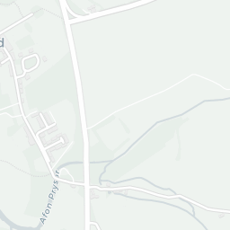
The large figure is how many we found nearby; the chip beside each label is that category’s NestScope score out of 100 — higher beats more of the UK.

Schools72/100
0Good/Outstanding within 1 mi

0 rated Good or better within 2 mi · 1 schools in total

No Good or Outstanding school within 2 mi

Safety96/100
1crimes last month

1 crime in 400m last month (residential-weighted: 0)

Crimes reported last month · UK Police API

Healthcare60/100
0GP & hospitals

pharmacy 0.0 mi within 1.5 mi

Transport53/100

No rail stations within 0.5 miles · 4 bus stops nearby

Green space56/100
6green spaces

1.6 ha total — largest park 0.7 ha (0.42 mi away)

Nearest: St Madryn's Church — 0.0 mi

Amenities51/100
1supermarkets

1 supermarket within 2 mi — Spar — nearest 0.3 mi

Nearest: Spar - Trawsfynydd — 0.3 mi

02 — Environment

Environment & risk near LL41 4RT.

Official risk flags for context — deliberately not part of the NestScope score (they’re categorical hazards, not amenities).

Flood risk
Zone 1 (low)

Flood Zone 1 — low risk (less than 1 in 1,000 annual chance) · Source: Environment Agency Flood Map for Planning

Zone 1
Zone 2
Zone 3
Air qualityWithin WHO guideline
1.4µg/m³

NO₂ annual mean · WHO guideline 10 · UK limit 40 · Source: DEFRA UK-AIR 2024

<10
10–20
20–30
30–40
≥40
03 — House prices

Sold prices in LL41.

Average sold price by property type across the LL41 district, 20212026601 sales.

£0£100k£200k£300k202120222023202420252026
  • Detached
  • Semi-detached
  • Terraced
  • Flat
Detached£180k 17.1%
Semi-detached£143k 3.5%
Terraced£113k 4.6%
Flat

District-level averages (LL41) — broad enough to show a reliable trend. A single postcode usually sees too few sales to chart. Source: HM Land Registry Price Paid Data (Crown Copyright / OGL v3.0).

About LL41 4RT

LL41 4RT scores 71/100 on the NestScope Score, with its strongest showing in safety and schools — with only 1 crime reported on the surrounding streets last month. The breakdown below draws on official UK data covering schools, safety, healthcare, transport, environment and local amenities.

Explore area insights about nearby locations

Data: DfE/Ofsted · UK Police API · NHS ODS · NaPTAN · Ordnance Survey · Geolytix. Crown Copyright / OGL. Look up any postcode: nestscope.uk/area/YOUR+POSTCODE — e.g. SW1A 1AA, M1 1AE, BS1 1HT.