NestScope
L20 7EW · Neighbourhood Report
© OpenStreetMap · © CARTO
Area Report
Last updated 13 JUN 2026

L20 7EW

Neighbourhood Report

What's nearby — across walking, short-drive and school catchment distance. Data from official UK government sources.

NestScope Score
49/ 100

A more affordable, lower-income neighbourhood

Anchored on official IMD data — decile 1/10, ranked 443 of 32,844 neighbourhoods in England.

How this score is calculated
01 — Snapshot

Around L20 7EW.

The large figure is how many we found nearby; the chip beside each label is that category’s NestScope score out of 100 — higher beats more of the UK.

Safety64/100

IMD crime decile 6/10 · live count unavailable

Data temporarily unavailable

Healthcare68/100
29GP & hospitals

IMD health decile 1/10 · 27 GP, 2 hospitals, 11 dentists, pharmacy 0.3 mi within 1.5 mi

Nearest GP: ANTIVIRALS SERVICE (NORTH) — 0.2 mi

Transport74/100
Bootle Oriel Road Rail Station0.3 mi
Kirkdale Rail Station0.5 mi

45 bus stops also within 0.5 miles

Green space70/100
12green spaces

IMD environment decile 4/10 · 10.6 ha total — largest park 6.1 ha (0.20 mi away)

Nearest: Stanley Garden — 0.1 mi

Amenities79/100
28supermarkets

28 supermarkets within 2 mi — Iceland, Spar, Heron, Asda… — nearest 0.5 mi — library 0.4 mi

Nearest: Iceland Bootle — 0.5 mi

02 — Environment

Environment & risk near L20 7EW.

Official risk flags for context — deliberately not part of the NestScope score (they’re categorical hazards, not amenities).

Flood risk
Zone 1 (low)

Flood Zone 1 — low risk (less than 1 in 1,000 annual chance) · Source: Environment Agency Flood Map for Planning

Zone 1
Zone 2
Zone 3
Air qualityLow
14.7µg/m³

NO₂ annual mean · WHO guideline 10 · UK limit 40 · Source: DEFRA UK-AIR 2024

<10
10–20
20–30
30–40
≥40
03 — House prices

Sold prices in L20.

Average sold price by property type across the L20 district, 202120262,387 sales.

£0£100k£200k£300k202120222023202420252026
  • Detached
  • Semi-detached
  • Terraced
  • Flat
Detached£249k 30.9%
Semi-detached£168k 15.0%
Terraced£106k 9.9%
Flat£64k 10.6%

District-level averages (L20) — broad enough to show a reliable trend. A single postcode usually sees too few sales to chart. Source: HM Land Registry Price Paid Data (Crown Copyright / OGL v3.0).

About L20 7EW

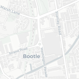
L20 7EW scores 49/100 on the NestScope Score, with its strongest showing in local amenities and transport — with Iceland Bootle about 10 minutes' walk away. The main trade-off is its schools score. The breakdown below draws on official UK data covering schools, safety, healthcare, transport, environment and local amenities.

In national context, L20 7EW is a more affordable, lower-income neighbourhood — IMD decile 1/10, ranked 443 of 32,844 neighbourhoods in England. The Index of Multiple Deprivation is the UK government's official measure of relative deprivation, refreshed roughly every five years. Housing pressure here is high (IMD housing decile 4/10).

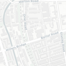
There are 47 schools within the typical catchment area, including 5 rated Outstanding by Ofsted and 24 rated Good. The nearest school is Hugh Baird College, within a short walk.

Healthcare access is good, with 27 GP surgeries, 2 hospitals and 11 dental practices in the wider neighbourhood. The nearest GP practice is ANTIVIRALS SERVICE (NORTH), about 4 minutes' walk away. The nearest hospital is CLOCK VIEW HOSPITAL, 1.0 mi away. A pharmacy is about 6 minutes' walk away.

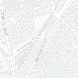
The nearest rail stations are Bootle Oriel Road Rail Station (Train, about 6 minutes' walk away), Kirkdale Rail Station (Train, about 9 minutes' walk away). There are also 45 bus stops within walking distance.

The location is in Flood Zone 1 (low risk — less than a 1 in 1,000 annual chance of river or sea flooding).

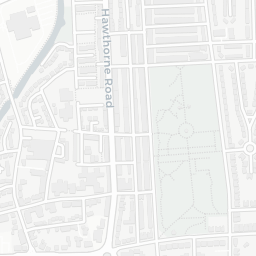
There are 12 green spaces within walking distance, totalling 10.6 hectares of parks and outdoor space. The nearest is Stanley Garden, within a short walk.

There are 28 supermarkets in the wider area, including Iceland, Spar, Heron, Asda and others. The nearest is Iceland Bootle, about 10 minutes' walk away. A public library is about 7 minutes' walk away.

Sources: DfE/Ofsted, UK Police API, NHS ODS, NaPTAN, Environment Agency, Ordnance Survey, Natural England, DEFRA, Geolytix and Arts Council England. For an interactive map view, explore L20 7EW on NestScope.

Explore area insights about nearby locations

Data: DfE/Ofsted · UK Police API · NHS ODS · NaPTAN · Ordnance Survey · Geolytix. Crown Copyright / OGL. Look up any postcode: nestscope.uk/area/YOUR+POSTCODE — e.g. SW1A 1AA, M1 1AE, BS1 1HT.

NestScope

All data from publicly available UK government sources. Each dimension uses a category-appropriate radius (walking distance for crime and transport, school catchment, drive distance for healthcare). IMD context is the latest published English Indices of Deprivation (2019). This report is for informational purposes only.