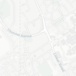
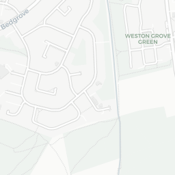
NestScope
HP21 8ES · Neighbourhood Report
© OpenStreetMap · © CARTO
Area Report
Last updated 13 JUN 2026

HP21 8ES

Neighbourhood Report

What's nearby — across walking, short-drive and school catchment distance. Data from official UK government sources.

NestScope Score
78/ 100

A well-off neighbourhood

Anchored on official IMD data — decile 8/10, ranked 23,875 of 32,844 neighbourhoods in England.

How this score is calculated
01 — Snapshot

Around HP21 8ES.

The large figure is how many we found nearby; the chip beside each label is that category’s NestScope score out of 100 — higher beats more of the UK.

Schools69/100
5Good/Outstanding within 1 mi

19 rated Good or better within 2 mi · 31 schools in total

Nearest top-rated: Ashmead Combined School (Good) — 0.3 mi

Safety80/100

IMD crime decile 8/10 · live count unavailable

Data temporarily unavailable

Healthcare88/100
8GP & hospitals

IMD health decile 8/10 · 7 GP, 1 hospital, 7 dentists, pharmacy 0.4 mi within 1.5 mi

Nearest GP: COMMUNITY AND REHABILITATION CARE GROUP — 0.3 mi

Transport79/100

No rail stations within 0.5 miles · 39 bus stops nearby

Green space84/100
13green spaces

IMD environment decile 10/10 · 14.8 ha total — largest park 4.2 ha (0.15 mi away)

Nearest: Playground (0.17 ha) — 0.1 mi

Amenities84/100
27supermarkets

27 supermarkets within 2 mi — Midcounties Co-operative, Budgens, The Co-operative Group, Asda… — nearest 0.3 mi — library 1.1 mi

Nearest: Co-op Orwell Drive Aylesbury — 0.3 mi

02 — Environment

Environment & risk near HP21 8ES.

Official risk flags for context — deliberately not part of the NestScope score (they’re categorical hazards, not amenities).

Flood risk
Zone 1 (low)

Flood Zone 1 — low risk (less than 1 in 1,000 annual chance) · Source: Environment Agency Flood Map for Planning

Zone 1
Zone 2
Zone 3
Air qualityWithin WHO guideline
6.5µg/m³

NO₂ annual mean · WHO guideline 10 · UK limit 40 · Source: DEFRA UK-AIR 2024

<10
10–20
20–30
30–40
≥40

About HP21 8ES

HP21 8ES scores 78/100 on the NestScope Score, with its strongest showing in healthcare and green space — with COMMUNITY AND REHABILITATION CARE GROUP about 7 minutes' walk away. The breakdown below draws on official UK data covering schools, safety, healthcare, transport, environment and local amenities.

In national context, HP21 8ES is a well-off neighbourhood — IMD decile 8/10, ranked 23,875 of 32,844 neighbourhoods in England. The Index of Multiple Deprivation is the UK government's official measure of relative deprivation, refreshed roughly every five years. Housing pressure here is high (IMD housing decile 3/10).

There are 31 schools within the typical catchment area, including 4 rated Outstanding by Ofsted and 15 rated Good. The nearest school is The Mandeville School, within a short walk.

Healthcare access is good, with 7 GP surgeries, 1 hospital and 7 dental practices in the wider neighbourhood. The nearest GP practice is COMMUNITY AND REHABILITATION CARE GROUP, about 7 minutes' walk away. The nearest hospital is STOKE MANDEVILLE HOSPITAL, about 10 minutes' walk away. A pharmacy is about 8 minutes' walk away.

There are no train or Tube stations near HP21 8ES. Bus services provide the main public transport, with 39 bus stops in the immediate area.

The location is in Flood Zone 1 (low risk — less than a 1 in 1,000 annual chance of river or sea flooding).

There are 13 green spaces within walking distance, totalling 14.8 hectares of parks and outdoor space. The nearest is Playground (0.17 ha), about 3 minutes' walk away.

There are 27 supermarkets in the wider area, including Midcounties Co-operative, Budgens, The Co-operative Group, Asda and others. The nearest is Co-op Orwell Drive Aylesbury, about 6 minutes' walk away. A public library is 1.1 mi away.

Sources: DfE/Ofsted, UK Police API, NHS ODS, NaPTAN, Environment Agency, Ordnance Survey, Natural England, DEFRA, Geolytix and Arts Council England. For an interactive map view, explore HP21 8ES on NestScope.

Data: DfE/Ofsted · UK Police API · NHS ODS · NaPTAN · Ordnance Survey · Geolytix. Crown Copyright / OGL. Look up any postcode: nestscope.uk/area/YOUR+POSTCODE — e.g. SW1A 1AA, M1 1AE, BS1 1HT.

NestScope

All data from publicly available UK government sources. Each dimension uses a category-appropriate radius (walking distance for crime and transport, school catchment, drive distance for healthcare). IMD context is the latest published English Indices of Deprivation (2019). This report is for informational purposes only.