Area Report
Last updated 27 JUL 2026Neighbourhood Report
A well-off pocket of Stroud: a school within a short walk, roughly 8 km² reachable within half an hour by public transport and recorded crime among the lowest in England — though there is little in the way of parkland nearby.
What's nearby — across walking, short-drive and school catchment distance. Data from official UK government sources.
01 — Snapshot
Around GL13 9JX.
The large figure is how many we found nearby; the chip beside each label is that category’s NestScope score out of 100 — higher beats more of the UK.
Are the schools any good?
0Good/Outstanding within 1 mi
- 0 rated Good or better within 2 mi
- 2 schools in total
- IMD education decile 8/10From the official English Indices of Deprivation (IMD 2019, gov.uk) — this neighbourhood's education domain sits in band 8 of 10 nationally (1 = most deprived, 10 = least). One of the anchor signals behind the NestScope Score.
No Good or Outstanding school within 2 mi
Is it safe?
0crimes last month
- IMD crime decile 9/10From the official English Indices of Deprivation (IMD 2019, gov.uk) — this neighbourhood's crime domain sits in band 9 of 10 nationally (1 = most deprived, 10 = least). One of the anchor signals behind the NestScope Score.
- no crimes in 0.25 mi last month
Crimes reported last month · UK Police API
Can I see a GP?
0GP & hospitals
- IMD health decile 10/10From the official English Indices of Deprivation (IMD 2019, gov.uk) — this neighbourhood's health domain sits in band 10 of 10 nationally (1 = most deprived, 10 = least). One of the anchor signals behind the NestScope Score.
- no GP / hospital / dentist within 1.5 mi
Can I get to work?
No rail stations within 0.5 miles · 4 bus stops nearby
NestReach: ≈ 8 km² reachable within 30 min by bus & rail · England median ≈ 7 km² See the reach map →
How green is it?
3green spaces
- IMD environment decile 3/10From the official English Indices of Deprivation (IMD 2019, gov.uk) — this neighbourhood's environment domain sits in band 3 of 10 nationally (1 = most deprived, 10 = least). One of the anchor signals behind the NestScope Score.
- 1.1 ha total
- no proper park nearby
Nearest: All Saints' Church — 0.1 mi
Can I get the shopping done?
3shops & libraries
- 3 supermarkets within 2 mi
- Marks and Spencer, Waitrose
Nearest: M&S Michaelwood North BP — 1.1 mi
02 — Environment
Environment & risk near GL13 9JX.
Official risk flags for context — deliberately not part of the NestScope score (they’re categorical hazards, not amenities). Flood zones, air quality & noise explained.
03 — House prices
Sold prices in GL13.
Average sold price by property type across the GL13 district, 2021–2026.
About GL13 9JX
GL13 9JX scores 80/100 on the NestScope Score, with its strongest showing in safety and schools — with no crimes reported on the surrounding streets last month. The main trade-off is its green space score. The breakdown below draws on official UK data covering schools, safety, healthcare, transport, environment and local amenities.
In national context, GL13 9JX is a well-off neighbourhood — IMD decile 8/10, ranked 23,379 of 32,844 neighbourhoods in England. The Index of Multiple Deprivation is the UK government's official measure of relative deprivation, refreshed roughly every five years. Housing pressure here is high (IMD housing decile 1/10).
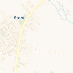
There are 2 schools within the typical catchment area. The nearest school is Stone with Woodford Church of England Primary School, within a short walk.
No crimes were reported on the surrounding streets in the most recent month, consistent with a very low local crime profile.
There are no GP surgeries, hospitals or pharmacies within easy reach of GL13 9JX. Residents may need to travel further for healthcare access.