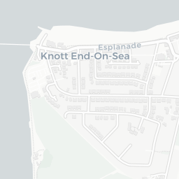
NestScope
FY7 6EX · Neighbourhood Report
© OpenStreetMap · © CARTO
Area Report
Last updated 13 JUN 2026

FY7 6EX

Neighbourhood Report

What's nearby — across walking, short-drive and school catchment distance. Data from official UK government sources.

NestScope Score
46/ 100

A more affordable, lower-income neighbourhood

Anchored on official IMD data — decile 2/10, ranked 3,892 of 32,844 neighbourhoods in England.

How this score is calculated
01 — Snapshot

Around FY7 6EX.

The large figure is how many we found nearby; the chip beside each label is that category’s NestScope score out of 100 — higher beats more of the UK.

Safety24/100

IMD crime decile 1/10 · live count unavailable

Data temporarily unavailable

Healthcare70/100
7GP & hospitals

IMD health decile 1/10 · 6 GP, 1 hospital, 2 dentists, pharmacy 0.2 mi within 1.5 mi

Nearest GP: O'BRIENS PHARMACY — 0.3 mi

Transport77/100
London Street (Blackpool Tramway)0.2 mi
Victoria Street (Blackpool Tramway)0.2 mi
Fleetwood Ferry (Blackpool Tramway)0.3 mi

27 bus stops also within 0.5 miles

Green space61/100
18green spaces

IMD environment decile 1/10 · 33.9 ha total — no proper park nearby

Nearest: Playground (300 m²) — 0.1 mi

Amenities93/100
11supermarkets

11 supermarkets within 2 mi — Spar, Iceland, Heron, Asda… — nearest 0.1 mi — library 0.3 mi

Nearest: Spar - Fleetwood — 0.1 mi

02 — Environment

Environment & risk near FY7 6EX.

Official risk flags for context — deliberately not part of the NestScope score (they’re categorical hazards, not amenities).

Flood risk
Zone 1 (low)

Flood Zone 1 — low risk (less than 1 in 1,000 annual chance) · Source: Environment Agency Flood Map for Planning

Zone 1
Zone 2
Zone 3
Air qualityWithin WHO guideline
4.3µg/m³

NO₂ annual mean · WHO guideline 10 · UK limit 40 · Source: DEFRA UK-AIR 2024

<10
10–20
20–30
30–40
≥40
03 — House prices

Sold prices in FY7.

Average sold price by property type across the FY7 district, 202120262,199 sales.

£0£100k£200k£300k202120222023202420252026
  • Detached
  • Semi-detached
  • Terraced
  • Flat
Detached£277k 22.8%
Semi-detached£173k 15.7%
Terraced£108k 0.2%
Flat£79k 8.8%

District-level averages (FY7) — broad enough to show a reliable trend. A single postcode usually sees too few sales to chart. Source: HM Land Registry Price Paid Data (Crown Copyright / OGL v3.0).

About FY7 6EX

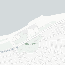
FY7 6EX scores 46/100 on the NestScope Score, with its strongest showing in local amenities and transport — with Spar - Fleetwood about 3 minutes' walk away. The main trade-off is its safety score. The breakdown below draws on official UK data covering schools, safety, healthcare, transport, environment and local amenities.

In national context, FY7 6EX is a more affordable, lower-income neighbourhood — IMD decile 2/10, ranked 3,892 of 32,844 neighbourhoods in England. The Index of Multiple Deprivation is the UK government's official measure of relative deprivation, refreshed roughly every five years. Housing pressure here is low (IMD housing decile 10/10).

There are 9 schools within the typical catchment area, including 5 rated Good. The nearest school is St. Mary's Catholic Primary School, Fleetwood (Ofsted: Requires Improvement), within a short walk.

Healthcare access is good, with 6 GP surgeries, 1 hospital and 2 dental practices in the wider neighbourhood. The nearest GP practice is O'BRIENS PHARMACY, about 6 minutes' walk away. The nearest hospital is FLEETWOOD HOSPITAL, about 5 minutes' walk away. A pharmacy is about 5 minutes' walk away.

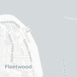
The nearest rail stations are London Street (Blackpool Tramway) (Tube/Metro, about 4 minutes' walk away), Victoria Street (Blackpool Tramway) (Tube/Metro, about 5 minutes' walk away), Fleetwood Ferry (Blackpool Tramway) (Tube/Metro, about 6 minutes' walk away). There are also 27 bus stops within walking distance.

The location is in Flood Zone 1 (low risk — less than a 1 in 1,000 annual chance of river or sea flooding).

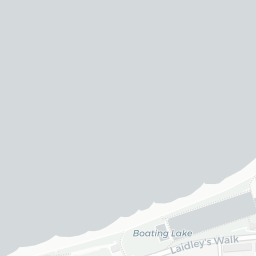
There are 18 green spaces within walking distance, totalling 33.9 hectares of parks and outdoor space. The nearest is Playground (300 m²), within a short walk.

There are 11 supermarkets in the wider area, including Spar, Iceland, Heron, Asda and others. The nearest is Spar - Fleetwood, about 3 minutes' walk away. A public library is about 5 minutes' walk away.

Sources: DfE/Ofsted, UK Police API, NHS ODS, NaPTAN, Environment Agency, Ordnance Survey, Natural England, DEFRA, Geolytix and Arts Council England. For an interactive map view, explore FY7 6EX on NestScope.

Explore area insights about nearby locations

Data: DfE/Ofsted · UK Police API · NHS ODS · NaPTAN · Ordnance Survey · Geolytix. Crown Copyright / OGL. Look up any postcode: nestscope.uk/area/YOUR+POSTCODE — e.g. SW1A 1AA, M1 1AE, BS1 1HT.

NestScope

All data from publicly available UK government sources. Each dimension uses a category-appropriate radius (walking distance for crime and transport, school catchment, drive distance for healthcare). IMD context is the latest published English Indices of Deprivation (2019). This report is for informational purposes only.