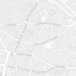
NestScope
EC2V 6AA · Neighbourhood Report
© OpenStreetMap · © CARTO
Area Report
Last updated 12 JUN 2026

EC2V 6AA

Neighbourhood Report

What's nearby — across walking, short-drive and school catchment distance. Data from official UK government sources.

NestScope Score
80/ 100

A well-off neighbourhood

Anchored on official IMD data — decile 7/10, ranked 20,391 of 32,844 neighbourhoods in England.

How this score is calculated
01 — Snapshot

Around EC2V 6AA.

The large figure is how many we found nearby; the chip beside each label is that category’s NestScope score out of 100 — higher beats more of the UK.

Schools93/100
15Good/Outstanding within 1 mi

104 rated Good or better within 2 mi · 182 schools in total

Nearest top-rated: Prior Weston Primary School and Children's Centre (Good) — 0.5 mi

Safety74/100
146crimes last month

IMD crime decile 10/10 · 146 crimes in 400m last month (residential-weighted: 53.8)

Crimes reported last month · UK Police API

Healthcare90/100
96GP & hospitals

IMD health decile 8/10 · 85 GP, 11 hospitals, 93 dentists, pharmacy 0.1 mi within 1.5 mi

Nearest GP: CIRCLE HEALTH GROUP — 0.2 mi

Transport96/100
City Thameslink Rail Station0.3 mi
London Blackfriars Rail Station0.3 mi
London Cannon Street Rail Station0.4 mi
St. Paul's Underground Station0.0 mi
Mansion House Underground Station0.2 mi

67 bus stops also within 0.5 miles

Green space49/100
19green spaces

IMD environment decile 1/10 · 6 ha total — no proper park nearby

Nearest: St Paul's Cathedral — 0.1 mi

Amenities94/100
206supermarkets

206 supermarkets within 2 mi — The Co-operative Group, Tesco, Sainsburys, Marks and Spencer… — nearest 0.0 mi — library 0.2 mi

Nearest: Co-op London - St Pauls — 0.0 mi

02 — Environment

Environment & risk near EC2V 6AA.

Official risk flags for context — deliberately not part of the NestScope score (they’re categorical hazards, not amenities).

Flood risk
Zone 1 (low)

Flood Zone 1 — low risk (less than 1 in 1,000 annual chance) · Source: Environment Agency Flood Map for Planning

Zone 1
Zone 2
Zone 3
Air qualityHigh (approaching UK limit)
32.8µg/m³

NO₂ annual mean · WHO guideline 10 · UK limit 40 · Source: DEFRA UK-AIR 2024

<10
10–20
20–30
30–40
≥40
Road noiseLoud
69dB Lden

Road traffic, day-evening-night average · Source: DEFRA strategic noise mapping

<55
55–64
65–74
≥75

About EC2V 6AA

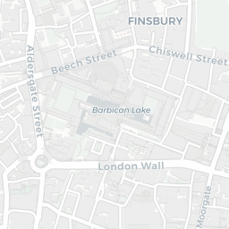
EC2V 6AA scores 80/100 on the NestScope Score, with its strongest showing in transport and local amenities — with City Thameslink Rail Station about 6 minutes' walk away. The breakdown below draws on official UK data covering schools, safety, healthcare, transport, environment and local amenities.

In national context, EC2V 6AA is a well-off neighbourhood — IMD decile 7/10, ranked 20,391 of 32,844 neighbourhoods in England. The Index of Multiple Deprivation is the UK government's official measure of relative deprivation, refreshed roughly every five years. Housing pressure here is high (IMD housing decile 1/10).

There are 182 schools within the typical catchment area, including 32 rated Outstanding by Ofsted and 72 rated Good. The nearest school is St Paul's Cathedral School, within a short walk.

There were 146 crimes reported on the surrounding streets in the most recent month, indicating a high level of immediate-area crime.

Healthcare access is good, with 85 GP surgeries, 11 hospitals and 93 dental practices in the wider neighbourhood. The nearest GP practice is CIRCLE HEALTH GROUP, about 4 minutes' walk away. The nearest hospital is ST BARTHOLOMEW'S HOSPITAL, about 5 minutes' walk away. A pharmacy is within a short walk.

The nearest rail stations are City Thameslink Rail Station (Train, about 6 minutes' walk away), London Blackfriars Rail Station (Train, about 7 minutes' walk away), London Cannon Street Rail Station (Train, about 7 minutes' walk away), St. Paul's Underground Station (Tube/Metro, within a short walk), Mansion House Underground Station (Tube/Metro, about 4 minutes' walk away), Mansion House Underground Station (Tube/Metro, about 5 minutes' walk away). There are also 67 bus stops within walking distance.

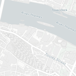
The location is in Flood Zone 1 (low risk — less than a 1 in 1,000 annual chance of river or sea flooding). road traffic noise is high (about 69 dB Lden).

There are 19 green spaces within walking distance, totalling 6 hectares of parks and outdoor space. The nearest is St Paul's Cathedral, within a short walk.

There are 206 supermarkets in the wider area, including The Co-operative Group, Tesco, Sainsburys, Marks and Spencer and others. The nearest is Co-op London - St Pauls, within a short walk. A public library is about 4 minutes' walk away.

Sources: DfE/Ofsted, UK Police API, NHS ODS, NaPTAN, Environment Agency, Ordnance Survey, Natural England, DEFRA, Geolytix and Arts Council England. For an interactive map view, explore EC2V 6AA on NestScope.

Explore area insights about nearby locations

Data: DfE/Ofsted · UK Police API · NHS ODS · NaPTAN · Ordnance Survey · Geolytix. Crown Copyright / OGL. Look up any postcode: nestscope.uk/area/YOUR+POSTCODE — e.g. SW1A 1AA, M1 1AE, BS1 1HT.

NestScope

All data from publicly available UK government sources. Each dimension uses a category-appropriate radius (walking distance for crime and transport, school catchment, drive distance for healthcare). IMD context is the latest published English Indices of Deprivation (2019). This report is for informational purposes only.