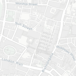
NestScope
EC2A 4JU · Neighbourhood Report
© OpenStreetMap · © CARTO
Area Report
Last updated 13 JUN 2026

EC2A 4JU

Neighbourhood Report

What's nearby — across walking, short-drive and school catchment distance. Data from official UK government sources.

NestScope Score
65/ 100

A mixed, mid-ranking neighbourhood

Anchored on official IMD data — decile 4/10, ranked 12,549 of 32,844 neighbourhoods in England.

How this score is calculated
01 — Snapshot

Around EC2A 4JU.

The large figure is how many we found nearby; the chip beside each label is that category’s NestScope score out of 100 — higher beats more of the UK.

Schools81/100
29Good/Outstanding within 1 mi

114 rated Good or better within 2 mi · 181 schools in total

Nearest top-rated: Prior Weston Primary School and Children's Centre (Good) — 0.4 mi

Safety64/100
220crimes last month

IMD crime decile 8/10 · 220 crimes in 400m last month (residential-weighted: 107)

Crimes reported last month · UK Police API

Healthcare81/100
79GP & hospitals

IMD health decile 5/10 · 71 GP, 8 hospitals, 85 dentists, pharmacy 0.3 mi within 1.5 mi

Nearest GP: LIVI SYSTMONE SOUTHAMPTON — 0.1 mi

Transport82/100
Old Street Rail Station0.3 mi
Moorgate Rail Station0.4 mi
London Liverpool Street Rail Station0.4 mi
Old Street Underground Station0.2 mi
Moorgate Underground Station0.3 mi

72 bus stops also within 0.5 miles

Green space65/100
33green spaces

IMD environment decile 3/10 · 11.6 ha total — largest park 2.5 ha (0.19 mi away)

Nearest: Wesley's Chapel — 0.1 mi

Amenities95/100
194supermarkets

194 supermarkets within 2 mi — Tesco, Sainsburys, Marks and Spencer, Aldi… — nearest 0.1 mi — library 0.5 mi

Nearest: Tesco City Rd Express — 0.1 mi

02 — Environment

Environment & risk near EC2A 4JU.

Official risk flags for context — deliberately not part of the NestScope score (they’re categorical hazards, not amenities).

Flood risk
Zone 1 (low)

Flood Zone 1 — low risk (less than 1 in 1,000 annual chance) · Source: Environment Agency Flood Map for Planning

Zone 1
Zone 2
Zone 3
Air qualityHigh (approaching UK limit)
30µg/m³

NO₂ annual mean · WHO guideline 10 · UK limit 40 · Source: DEFRA UK-AIR 2024

<10
10–20
20–30
30–40
≥40
03 — House prices

Sold prices in EC2A.

Average sold price by property type across the EC2A district, 20212026490 sales.

£0£500k£1M£1.5M£2M202120222023202420252026
  • Detached
  • Semi-detached
  • Terraced
  • Flat
Detached
Semi-detached
Terraced£1.7M
Flat£462k 55.4%

District-level averages (EC2A) — broad enough to show a reliable trend. A single postcode usually sees too few sales to chart. Source: HM Land Registry Price Paid Data (Crown Copyright / OGL v3.0).

About EC2A 4JU

EC2A 4JU scores 65/100 on the NestScope Score, with its strongest showing in local amenities and transport — with Tesco City Rd Express about 2 minutes' walk away. The breakdown below draws on official UK data covering schools, safety, healthcare, transport, environment and local amenities.

In national context, EC2A 4JU is a mixed, mid-ranking neighbourhood — IMD decile 4/10, ranked 12,549 of 32,844 neighbourhoods in England. The Index of Multiple Deprivation is the UK government's official measure of relative deprivation, refreshed roughly every five years. Housing pressure here is high (IMD housing decile 2/10).

There are 181 schools within the typical catchment area, including 38 rated Outstanding by Ofsted and 76 rated Good. The nearest school is The Lyceum, within a short walk.

There were 220 crimes reported on the surrounding streets in the most recent month, indicating a high level of immediate-area crime.

Healthcare access is good, with 71 GP surgeries, 8 hospitals and 85 dental practices in the wider neighbourhood. The nearest GP practice is LIVI SYSTMONE SOUTHAMPTON, within a short walk. The nearest hospital is MOORFIELDS EYE HOSPITAL NHST, about 7 minutes' walk away. A pharmacy is about 6 minutes' walk away.

The nearest rail stations are Old Street Rail Station (Train, about 5 minutes' walk away), Moorgate Rail Station (Train, about 7 minutes' walk away), London Liverpool Street Rail Station (Train, about 8 minutes' walk away), Old Street Underground Station (Tube/Metro, about 4 minutes' walk away), Old Street Underground Station (Tube/Metro, about 5 minutes' walk away), Moorgate Underground Station (Tube/Metro, about 6 minutes' walk away). There are also 72 bus stops within walking distance.

The location is in Flood Zone 1 (low risk — less than a 1 in 1,000 annual chance of river or sea flooding).

There are 33 green spaces within walking distance, totalling 11.6 hectares of parks and outdoor space. The nearest is Wesley's Chapel, within a short walk.

There are 194 supermarkets in the wider area, including Tesco, Sainsburys, Marks and Spencer, Aldi and others. The nearest is Tesco City Rd Express, about 2 minutes' walk away. A public library is about 9 minutes' walk away.

Sources: DfE/Ofsted, UK Police API, NHS ODS, NaPTAN, Environment Agency, Ordnance Survey, Natural England, DEFRA, Geolytix and Arts Council England. For an interactive map view, explore EC2A 4JU on NestScope.

Explore area insights about nearby locations

Data: DfE/Ofsted · UK Police API · NHS ODS · NaPTAN · Ordnance Survey · Geolytix. Crown Copyright / OGL. Look up any postcode: nestscope.uk/area/YOUR+POSTCODE — e.g. SW1A 1AA, M1 1AE, BS1 1HT.

NestScope

All data from publicly available UK government sources. Each dimension uses a category-appropriate radius (walking distance for crime and transport, school catchment, drive distance for healthcare). IMD context is the latest published English Indices of Deprivation (2019). This report is for informational purposes only.