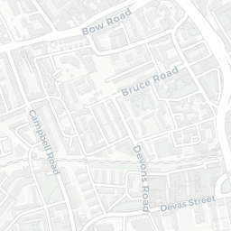
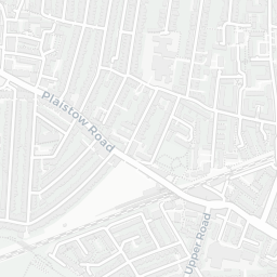
NestScope
E15 3AF · Neighbourhood Report
© OpenStreetMap · © CARTO
Area Report
Last updated 12 JUN 2026

E15 3AF

Neighbourhood Report

What's nearby — across walking, short-drive and school catchment distance. Data from official UK government sources.

NestScope Score
52/ 100

A more affordable, lower-income neighbourhood

Anchored on official IMD data — decile 2/10, ranked 6,133 of 32,844 neighbourhoods in England.

How this score is calculated
01 — Snapshot

Around E15 3AF.

The large figure is how many we found nearby; the chip beside each label is that category’s NestScope score out of 100 — higher beats more of the UK.

Schools64/100
20Good/Outstanding within 1 mi

92 rated Good or better within 2 mi · 141 schools in total

Nearest top-rated: Star Primary School (Good) — 0.3 mi

Safety40/100
63crimes last month

IMD crime decile 3/10 · 63 crimes in 400m last month (residential-weighted: 40.2)

Crimes reported last month · UK Police API

Healthcare77/100
52GP & hospitals

IMD health decile 4/10 · 51 GP, 1 hospital, 23 dentists, pharmacy 0.2 mi within 1.5 mi

Nearest GP: SOUTH ONE NEWHAM PCN HUB — 0.4 mi

Transport79/100
West Ham Rail Station0.3 mi
West Ham Underground Station0.2 mi
West Ham DLR Station0.2 mi
West Ham Underground Station0.2 mi

22 bus stops also within 0.5 miles

Green space70/100
22green spaces

IMD environment decile 3/10 · 35.9 ha total — largest park 12.9 ha (0.27 mi away)

Nearest: Playground (200 m²) — 0.1 mi

Amenities84/100
69supermarkets

69 supermarkets within 2 mi — Sainsburys, Iceland, The Co-operative Group, Tesco… — nearest 0.1 mi — library 0.6 mi

Nearest: Sainsbury's Avery Avenue — 0.1 mi

02 — Environment

Environment & risk near E15 3AF.

Official risk flags for context — deliberately not part of the NestScope score (they’re categorical hazards, not amenities).

Flood risk
Zone 1 (low)

Flood Zone 1 — low risk (less than 1 in 1,000 annual chance) · Source: Environment Agency Flood Map for Planning

Zone 1
Zone 2
Zone 3
Air qualityModerate
20.5µg/m³

NO₂ annual mean · WHO guideline 10 · UK limit 40 · Source: DEFRA UK-AIR 2024

<10
10–20
20–30
30–40
≥40
03 — House prices

Sold prices in E15.

Average sold price by property type across the E15 district, 202120262,466 sales.

£0£200k£400k£600k£800k202120222023202420252026
  • Detached
  • Semi-detached
  • Terraced
  • Flat
Detached£610k
Semi-detached£542k 10.1%
Terraced£560k 12.5%
Flat£376k 10.0%

District-level averages (E15) — broad enough to show a reliable trend. A single postcode usually sees too few sales to chart. Source: HM Land Registry Price Paid Data (Crown Copyright / OGL v3.0).

About E15 3AF

E15 3AF scores 52/100 on the NestScope Score, with its strongest showing in local amenities and transport — with Sainsbury's Avery Avenue about 3 minutes' walk away. The main trade-off is its safety score. The breakdown below draws on official UK data covering schools, safety, healthcare, transport, environment and local amenities.

In national context, E15 3AF is a more affordable, lower-income neighbourhood — IMD decile 2/10, ranked 6,133 of 32,844 neighbourhoods in England. The Index of Multiple Deprivation is the UK government's official measure of relative deprivation, refreshed roughly every five years. Housing pressure here is high (IMD housing decile 1/10).

There are 141 schools within the typical catchment area, including 38 rated Outstanding by Ofsted and 54 rated Good. The nearest school is Gainsborough Primary School, within a short walk.

There were 63 crimes reported on the surrounding streets in the most recent month, indicating a elevated level of immediate-area crime.

Healthcare access is good, with 51 GP surgeries, 1 hospital and 23 dental practices in the wider neighbourhood. The nearest GP practice is SOUTH ONE NEWHAM PCN HUB, about 8 minutes' walk away. The nearest hospital is NEWHAM GENERAL HOSPITAL, 1.3 mi away. A pharmacy is about 5 minutes' walk away.

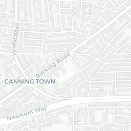
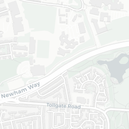
The nearest rail stations are West Ham Rail Station (Train, about 5 minutes' walk away), West Ham Underground Station (Tube/Metro, about 4 minutes' walk away), West Ham DLR Station (Tube/Metro, about 5 minutes' walk away), West Ham Underground Station (Tube/Metro, about 5 minutes' walk away). There are also 22 bus stops within walking distance.

The location is in Flood Zone 1 (low risk — less than a 1 in 1,000 annual chance of river or sea flooding).

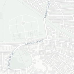
There are 22 green spaces within walking distance, totalling 35.9 hectares of parks and outdoor space. The nearest is Playground (200 m²), about 3 minutes' walk away.

There are 69 supermarkets in the wider area, including Sainsburys, Iceland, The Co-operative Group, Tesco and others. The nearest is Sainsbury's Avery Avenue, about 3 minutes' walk away. A public library is about 12 minutes' walk away.

Sources: DfE/Ofsted, UK Police API, NHS ODS, NaPTAN, Environment Agency, Ordnance Survey, Natural England, DEFRA, Geolytix and Arts Council England. For an interactive map view, explore E15 3AF on NestScope.

Explore area insights about nearby locations

Data: DfE/Ofsted · UK Police API · NHS ODS · NaPTAN · Ordnance Survey · Geolytix. Crown Copyright / OGL. Look up any postcode: nestscope.uk/area/YOUR+POSTCODE — e.g. SW1A 1AA, M1 1AE, BS1 1HT.

NestScope

All data from publicly available UK government sources. Each dimension uses a category-appropriate radius (walking distance for crime and transport, school catchment, drive distance for healthcare). IMD context is the latest published English Indices of Deprivation (2019). This report is for informational purposes only.