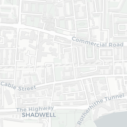
NestScope
E1 5AW · Neighbourhood Report
© OpenStreetMap · © CARTO
Area Report
Last updated 12 JUN 2026

E1 5AW

Neighbourhood Report

What's nearby — across walking, short-drive and school catchment distance. Data from official UK government sources.

NestScope Score
55/ 100

A mixed, mid-ranking neighbourhood

Anchored on official IMD data — decile 3/10, ranked 8,621 of 32,844 neighbourhoods in England.

How this score is calculated
01 — Snapshot

Around E1 5AW.

The large figure is how many we found nearby; the chip beside each label is that category’s NestScope score out of 100 — higher beats more of the UK.

Schools70/100
40Good/Outstanding within 1 mi

122 rated Good or better within 2 mi · 168 schools in total

Nearest top-rated: Osmani Primary School (Good) — 0.1 mi

Safety35/100
115crimes last month

IMD crime decile 2/10 · 115 crimes in 400m last month (residential-weighted: 56.1)

Crimes reported last month · UK Police API

Healthcare82/100
82GP & hospitals

IMD health decile 5/10 · 73 GP, 9 hospitals, 69 dentists, pharmacy 0.3 mi within 1.5 mi

Nearest GP: CGL TOWER HAMLETS — 0.2 mi

Transport82/100
Whitechapel Rail Station0.3 mi
Bethnal Green Rail Station0.3 mi
Shoreditch High Street Rail Station0.4 mi
Whitechapel Underground Station0.3 mi
Aldgate East Underground Station0.5 mi

40 bus stops also within 0.5 miles

Green space62/100
44green spaces

IMD environment decile 3/10 · 16 ha total — no proper park nearby

Nearest: Playground (200 m²) — 0.1 mi

Amenities95/100
165supermarkets

165 supermarkets within 2 mi — Asda, Tesco, Budgens, Sainsburys… — nearest 0.1 mi — library 0.4 mi

Nearest: Asda Bethnal Green Vallance Road Petrol Filling Station — 0.1 mi

02 — Environment

Environment & risk near E1 5AW.

Official risk flags for context — deliberately not part of the NestScope score (they’re categorical hazards, not amenities).

Flood risk
Zone 1 (low)

Flood Zone 1 — low risk (less than 1 in 1,000 annual chance) · Source: Environment Agency Flood Map for Planning

Zone 1
Zone 2
Zone 3
Air qualityModerate
25.6µg/m³

NO₂ annual mean · WHO guideline 10 · UK limit 40 · Source: DEFRA UK-AIR 2024

<10
10–20
20–30
30–40
≥40
03 — House prices

Sold prices in E1.

Average sold price by property type across the E1 district, 202120263,194 sales.

£0£1M£2M£3M£4M202120222023202420252026
  • Detached
  • Semi-detached
  • Terraced
  • Flat
Detached
Semi-detached
Terraced£591k 40.0%
Flat£503k 2.8%

District-level averages (E1) — broad enough to show a reliable trend. A single postcode usually sees too few sales to chart. Source: HM Land Registry Price Paid Data (Crown Copyright / OGL v3.0).

About E1 5AW

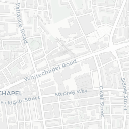
E1 5AW scores 55/100 on the NestScope Score, with its strongest showing in local amenities and healthcare — with Asda Bethnal Green Vallance Road Petrol Filling Station about 2 minutes' walk away. The main trade-off is its safety score. The breakdown below draws on official UK data covering schools, safety, healthcare, transport, environment and local amenities.

In national context, E1 5AW is a mixed, mid-ranking neighbourhood — IMD decile 3/10, ranked 8,621 of 32,844 neighbourhoods in England. The Index of Multiple Deprivation is the UK government's official measure of relative deprivation, refreshed roughly every five years. Housing pressure here is high (IMD housing decile 3/10).

There are 168 schools within the typical catchment area, including 41 rated Outstanding by Ofsted and 81 rated Good. The nearest school is Osmani Primary School (Ofsted: Good), within a short walk.

There were 115 crimes reported on the surrounding streets in the most recent month, indicating a high level of immediate-area crime.

Healthcare access is good, with 73 GP surgeries, 9 hospitals and 69 dental practices in the wider neighbourhood. The nearest GP practice is CGL TOWER HAMLETS, about 4 minutes' walk away. The nearest hospital is BARTS HOSPITAL AT HOME, about 6 minutes' walk away. A pharmacy is about 5 minutes' walk away.

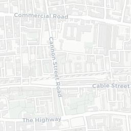
The nearest rail stations are Whitechapel Rail Station (Train, about 6 minutes' walk away), Bethnal Green Rail Station (Train, about 7 minutes' walk away), Shoreditch High Street Rail Station (Train, about 8 minutes' walk away), Whitechapel Underground Station (Tube/Metro, about 5 minutes' walk away), Whitechapel Underground Station (Tube/Metro, about 6 minutes' walk away), Aldgate East Underground Station (Tube/Metro, about 9 minutes' walk away). There are also 40 bus stops within walking distance.

The location is in Flood Zone 1 (low risk — less than a 1 in 1,000 annual chance of river or sea flooding).

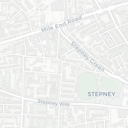
There are 44 green spaces within walking distance, totalling 16 hectares of parks and outdoor space. The nearest is Playground (200 m²), within a short walk.

There are 165 supermarkets in the wider area, including Asda, Tesco, Budgens, Sainsburys and others. The nearest is Asda Bethnal Green Vallance Road Petrol Filling Station, about 2 minutes' walk away. A public library is about 7 minutes' walk away.

Sources: DfE/Ofsted, UK Police API, NHS ODS, NaPTAN, Environment Agency, Ordnance Survey, Natural England, DEFRA, Geolytix and Arts Council England. For an interactive map view, explore E1 5AW on NestScope.

Explore area insights about nearby locations

Data: DfE/Ofsted · UK Police API · NHS ODS · NaPTAN · Ordnance Survey · Geolytix. Crown Copyright / OGL. Look up any postcode: nestscope.uk/area/YOUR+POSTCODE — e.g. SW1A 1AA, M1 1AE, BS1 1HT.

NestScope

All data from publicly available UK government sources. Each dimension uses a category-appropriate radius (walking distance for crime and transport, school catchment, drive distance for healthcare). IMD context is the latest published English Indices of Deprivation (2019). This report is for informational purposes only.