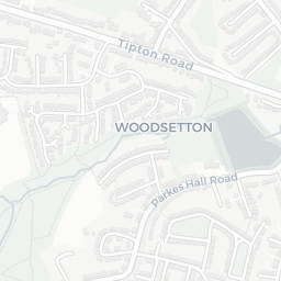
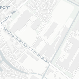
NestScope
DY4 8PR · Neighbourhood Report
© OpenStreetMap · © CARTO
Area Report
Last updated 15 JUN 2026

DY4 8PR

Neighbourhood Report

What's nearby — across walking, short-drive and school catchment distance. Data from official UK government sources.

NestScope Score
45/ 100

A more affordable, lower-income neighbourhood

Anchored on official IMD data — decile 1/10, ranked 1,886 of 32,844 neighbourhoods in England.

How this score is calculated
01 — Snapshot

Around DY4 8PR.

The large figure is how many we found nearby; the chip beside each label is that category’s NestScope score out of 100 — higher beats more of the UK.

Safety40/100

IMD crime decile 3/10 · live count unavailable

Data temporarily unavailable

Healthcare69/100
22GP & hospitals

IMD health decile 1/10 · 21 GP, 1 hospital, 15 dentists, pharmacy 0.3 mi within 1.5 mi

Nearest GP: BLACK COUNTRY FAMILY PRACTICE — 0.3 mi

Transport74/100
Tipton Rail Station0.4 mi
Sedgley Road (West Midlands Metro)0.3 mi
Birmingham New Road (West Midlands Metro)0.3 mi

30 bus stops also within 0.5 miles

Green space74/100
9green spaces

IMD environment decile 3/10 · 19.9 ha total — largest park 13.4 ha (0.12 mi away)

Nearest: Playground (800 m²) — 0.1 mi

Amenities79/100
23supermarkets

23 supermarkets within 2 mi — Morrisons, Midcounties Co-operative, Tesco, Aldi… — nearest 0.6 mi — library 0.3 mi

Nearest: Morrisons Daily Dudley Port — 0.6 mi

02 — Environment

Environment & risk near DY4 8PR.

Official risk flags for context — deliberately not part of the NestScope score (they’re categorical hazards, not amenities).

Flood risk
Zone 1 (low)

Flood Zone 1 — low risk (less than 1 in 1,000 annual chance) · Source: Environment Agency Flood Map for Planning

Zone 1
Zone 2
Zone 3
Air qualityLow
14.8µg/m³

NO₂ annual mean · WHO guideline 10 · UK limit 40 · Source: DEFRA UK-AIR 2024

<10
10–20
20–30
30–40
≥40
Road noiseQuiet
51dB Lden

Road traffic, day-evening-night average · Source: DEFRA strategic noise mapping

<55
55–64
65–74
≥75
Rail noiseQuiet
43dB Lden

Railways, day-evening-night average · Source: DEFRA strategic noise mapping

<55
55–64
65–74
≥75
03 — House prices

Sold prices in DY4.

Average sold price by property type across the DY4 district, 202120262,488 sales.

£0£100k£200k£300k202120222023202420252026
  • Detached
  • Semi-detached
  • Terraced
  • Flat
Detached£295k 19.6%
Semi-detached£219k 31.3%
Terraced£183k 18.6%
Flat£89k 11.0%

District-level averages (DY4) — broad enough to show a reliable trend. A single postcode usually sees too few sales to chart. Source: HM Land Registry Price Paid Data (Crown Copyright / OGL v3.0).

About DY4 8PR

DY4 8PR scores 45/100 on the NestScope Score, with its strongest showing in local amenities and transport — with Morrisons Daily Dudley Port about 12 minutes' walk away. The main trade-off is its safety score. The breakdown below draws on official UK data covering schools, safety, healthcare, transport, environment and local amenities.

In national context, DY4 8PR is a more affordable, lower-income neighbourhood — IMD decile 1/10, ranked 1,886 of 32,844 neighbourhoods in England. The Index of Multiple Deprivation is the UK government's official measure of relative deprivation, refreshed roughly every five years. Housing pressure here is moderate (IMD housing decile 5/10).

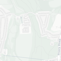
There are 51 schools within the typical catchment area, including 1 rated Outstanding by Ofsted and 28 rated Good. The nearest school is Silvertrees Academy, within a short walk.

Healthcare access is good, with 21 GP surgeries, 1 hospital and 15 dental practices in the wider neighbourhood. The nearest GP practice is BLACK COUNTRY FAMILY PRACTICE, about 6 minutes' walk away. The nearest hospital is GUEST HOSPITAL, about 10 minutes' walk away. A pharmacy is about 6 minutes' walk away.

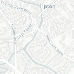
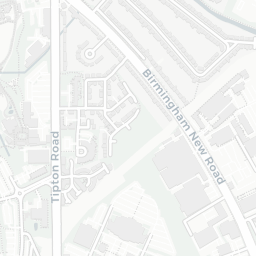
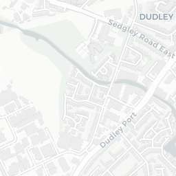
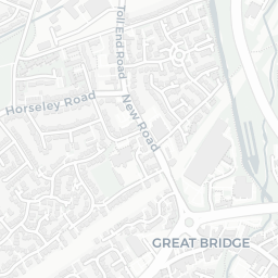
The nearest rail stations are Tipton Rail Station (Train, about 7 minutes' walk away), Sedgley Road (West Midlands Metro) (Tube/Metro, about 7 minutes' walk away), Birmingham New Road (West Midlands Metro) (Tube/Metro, about 7 minutes' walk away). There are also 30 bus stops within walking distance.

The location is in Flood Zone 1 (low risk — less than a 1 in 1,000 annual chance of river or sea flooding). road traffic noise is low (about 51 dB Lden), and rail noise is low (about 43 dB Lden).

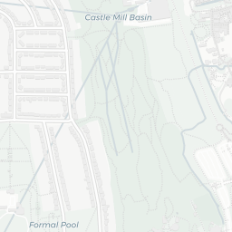
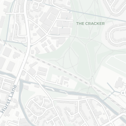
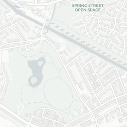
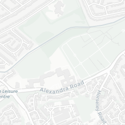
There are 9 green spaces within walking distance, totalling 19.9 hectares of parks and outdoor space. The nearest is Playground (800 m²), about 2 minutes' walk away. It also lies just beside a nature reserve (0.8 mi away), adding open countryside that isn't recorded as a formal park.

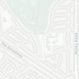
There are 23 supermarkets in the wider area, including Morrisons, Midcounties Co-operative, Tesco, Aldi and others. The nearest is Morrisons Daily Dudley Port, about 12 minutes' walk away. A public library is about 6 minutes' walk away.

Sources: DfE/Ofsted, UK Police API, NHS ODS, NaPTAN, Environment Agency, Ordnance Survey, Natural England, DEFRA, Geolytix and Arts Council England. For an interactive map view, explore DY4 8PR on NestScope.

Explore area insights about nearby locations

Data: DfE/Ofsted · UK Police API · NHS ODS · NaPTAN · Ordnance Survey · Geolytix. Crown Copyright / OGL. Look up any postcode: nestscope.uk/area/YOUR+POSTCODE — e.g. SW1A 1AA, M1 1AE, BS1 1HT.