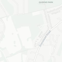
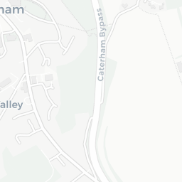
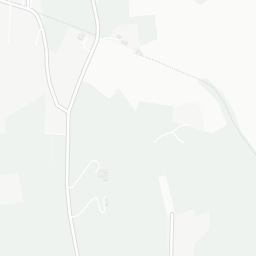
NestScope
CR3 7YA · Neighbourhood Report
© OpenStreetMap · © CARTO
Area Report
Last updated 13 JUN 2026

CR3 7YA

Neighbourhood Report

What's nearby — across walking, short-drive and school catchment distance. Data from official UK government sources.

NestScope Score
80/ 100

One of the most affluent neighbourhoods in England

Anchored on official IMD data — decile 9/10, ranked 26,977 of 32,844 neighbourhoods in England.

How this score is calculated
01 — Snapshot

Around CR3 7YA.

The large figure is how many we found nearby; the chip beside each label is that category’s NestScope score out of 100 — higher beats more of the UK.

Schools80/100
1Good/Outstanding within 1 mi

8 rated Good or better within 2 mi · 13 schools in total

Nearest top-rated: St John's CofE Aided Primary School (Good) — 0.9 mi

Safety72/100
0crimes last month

IMD crime decile 5/10 · no crimes in 400m last month

Crimes reported last month · UK Police API

Healthcare87/100
3GP & hospitals

IMD health decile 10/10 · 2 GP, 1 hospital, 2 dentists, pharmacy 1.2 mi within 1.5 mi

Nearest GP: CESP GLAUCOMA (CANTERBURY) — 1.2 mi

Transport62/100

No rail stations within 0.5 miles

Green space82/100
1green spaces

IMD environment decile 7/10 · within AONB (0.1 ha total — no proper park nearby)

Nearest: Cemetery (900 m²) — 0.3 mi

Amenities68/100
6supermarkets

6 supermarkets within 2 mi — Morrisons, Waitrose, Lidl, Aldi… — library 1.3 mi

Nearest: Morrisons Caterham — 1.1 mi

02 — Environment

Environment & risk near CR3 7YA.

Official risk flags for context — deliberately not part of the NestScope score (they’re categorical hazards, not amenities).

Flood risk
Zone 1 (low)

Flood Zone 1 — low risk (less than 1 in 1,000 annual chance) · Source: Environment Agency Flood Map for Planning

Zone 1
Zone 2
Zone 3
Air qualityWithin WHO guideline
9.1µg/m³

NO₂ annual mean · WHO guideline 10 · UK limit 40 · Source: DEFRA UK-AIR 2024

<10
10–20
20–30
30–40
≥40
03 — House prices

Sold prices in CR3.

Average sold price by property type across the CR3 district, 202120262,740 sales.

£0£250k£500k£750k£1M202120222023202420252026
  • Detached
  • Semi-detached
  • Terraced
  • Flat
Detached£789k 5.7%
Semi-detached£459k 1.8%
Terraced£525k 31.0%
Flat£266k 5.1%

District-level averages (CR3) — broad enough to show a reliable trend. A single postcode usually sees too few sales to chart. Source: HM Land Registry Price Paid Data (Crown Copyright / OGL v3.0).

About CR3 7YA

CR3 7YA scores 80/100 on the NestScope Score, with its strongest showing in healthcare and green space — with CESP GLAUCOMA (CANTERBURY) 1.2 mi away. The breakdown below draws on official UK data covering schools, safety, healthcare, transport, environment and local amenities.

In national context, CR3 7YA is one of the most affluent neighbourhoods in England — IMD decile 9/10, ranked 26,977 of 32,844 neighbourhoods in England. The Index of Multiple Deprivation is the UK government's official measure of relative deprivation, refreshed roughly every five years. Housing pressure here is high (IMD housing decile 2/10).

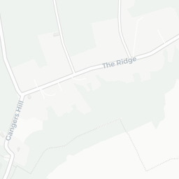
There are 13 schools within the typical catchment area, including 2 rated Outstanding by Ofsted and 6 rated Good. The nearest school is Woldingham School, within a short walk.

No crimes were reported on the surrounding streets in the most recent month, consistent with a very low local crime profile.

Healthcare access is good, with 2 GP surgeries, 1 hospital and 2 dental practices in the wider neighbourhood. The nearest GP practice is CESP GLAUCOMA (CANTERBURY), 1.2 mi away. The nearest hospital is NORTH DOWNS HOSPITAL, 1.3 mi away. A pharmacy is 1.2 mi away.

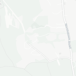
There are no public transport stops near CR3 7YA, making this a more car-dependent location.

The location is in Flood Zone 1 (low risk — less than a 1 in 1,000 annual chance of river or sea flooding).

There is 1 green space within walking distance, totalling 0.1 hectares of parks and outdoor space. The nearest is Cemetery (900 m²), about 6 minutes' walk away. The postcode sits within a AONB, giving it open countryside on the doorstep that isn't recorded as a formal park.

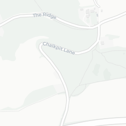
There are 6 supermarkets in the wider area, including Morrisons, Waitrose, Lidl, Aldi and others. The nearest is Morrisons Caterham, 1.1 mi away. A public library is 1.3 mi away.

Sources: DfE/Ofsted, UK Police API, NHS ODS, NaPTAN, Environment Agency, Ordnance Survey, Natural England, DEFRA, Geolytix and Arts Council England. For an interactive map view, explore CR3 7YA on NestScope.

Data: DfE/Ofsted · UK Police API · NHS ODS · NaPTAN · Ordnance Survey · Geolytix. Crown Copyright / OGL. Look up any postcode: nestscope.uk/area/YOUR+POSTCODE — e.g. SW1A 1AA, M1 1AE, BS1 1HT.

NestScope

All data from publicly available UK government sources. Each dimension uses a category-appropriate radius (walking distance for crime and transport, school catchment, drive distance for healthcare). IMD context is the latest published English Indices of Deprivation (2019). This report is for informational purposes only.