Nearest top-rated: Mill View Primary School (Outstanding) — 0.4 mi
Safety86/100
9crimes last month
IMD crime decile 9/10 · 9 crimes in 400m last month (residential-weighted: 4.6)
Crimes reported last month · UK Police API
Healthcare87/100
31GP & hospitals
IMD health decile 7/10 · 29 GP, 2 hospitals, 13 dentists, pharmacy 0.1 mi within 1.5 mi
Nearest GP: PARK MEDICAL CENTRE — 0.3 mi
Transport76/100
No rail stations within 0.5 miles · 33 bus stops nearby
Green space74/100
19green spaces
IMD environment decile 6/10 · 19.2 ha total — largest park 6.2 ha (0.27 mi away)
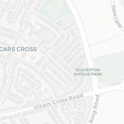
Nearest: Kingsway Allotments — 0.1 mi
Amenities91/100
33supermarkets
33 supermarkets within 2 mi — Morrisons, Cook, The Co-operative Group, Heron… — nearest 0.3 mi — library 0.5 mi
Nearest: Morrisons Daily Chester Brook Lane — 0.3 mi
02 — Environment
Environment & risk near CH2 2LA.
Official risk flags for context — deliberately not part of the NestScope score (they’re categorical hazards, not amenities).
Flood risk
Zone 1 (low)
Flood Zone 1 — low risk (less than 1 in 1,000 annual chance) · Source: Environment Agency Flood Map for Planning
▼
Zone 1
Zone 2
Zone 3
Air qualityWithin WHO guideline
9.8µg/m³
NO₂ annual mean · WHO guideline 10 · UK limit 40 · Source: DEFRA UK-AIR 2024
▼
<10
10–20
20–30
30–40
≥40
Road noiseQuiet
49dB Lden
Road traffic, day-evening-night average · Source: DEFRA strategic noise mapping
▼
<55
55–64
65–74
≥75
Rail noiseQuiet
47dB Lden
Railways, day-evening-night average · Source: DEFRA strategic noise mapping
▼
<55
55–64
65–74
≥75
03 — House prices
Sold prices in CH2.
Average sold price by property type across the CH2 district, 2021–2026 — 3,157 sales.
Detached
Semi-detached
Terraced
Flat
Detached£378k▲ 2.6%
Semi-detached£367k▲ 33.2%
Terraced£272k▲ 20.1%
Flat£170k▲ 18.2%
District-level averages (CH2) — broad enough to show a reliable trend. A single postcode usually sees too few sales to chart. Source: HM Land Registry Price Paid Data (Crown Copyright / OGL v3.0).
About CH2 2LA
CH2 2LA scores 89/100 on the NestScope Score, with its strongest showing in local amenities and healthcare — with Morrisons Daily Chester Brook Lane about 5 minutes' walk away. The breakdown below draws on official UK data covering schools, safety, healthcare, transport, environment and local amenities.
In national context, CH2 2LA is one of the most affluent neighbourhoods in England — IMD decile 10/10, ranked 29,898 of 32,844 neighbourhoods in England. The Index of Multiple Deprivation is the UK government's official measure of relative deprivation, refreshed roughly every five years. Housing pressure here is low (IMD housing decile 10/10).
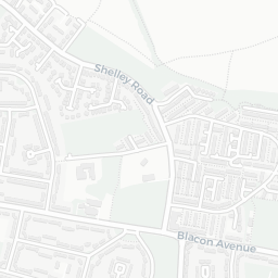
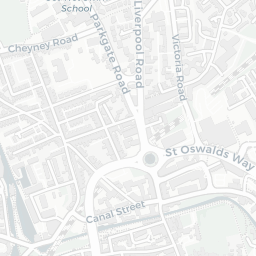
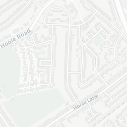
There are 31 schools within the typical catchment area, including 4 rated Outstanding by Ofsted and 15 rated Good. The nearest school is Newton Primary School (Ofsted: Requires Improvement), within a short walk.
There were 9 crimes reported on the surrounding streets in the most recent month, indicating a low level of immediate-area crime.
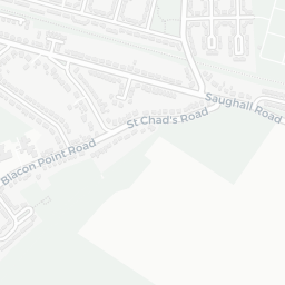
Healthcare access is good, with 29 GP surgeries, 2 hospitals and 13 dental practices in the wider neighbourhood. The nearest GP practice is PARK MEDICAL CENTRE, about 6 minutes' walk away. The nearest hospital is COUNTESS OF CHESTER HOSPITAL, 0.9 mi away. A pharmacy is within a short walk.
There are no train or Tube stations near CH2 2LA. Bus services provide the main public transport, with 33 bus stops in the immediate area.
The location is in Flood Zone 1 (low risk — less than a 1 in 1,000 annual chance of river or sea flooding). road traffic noise is low (about 49 dB Lden), and rail noise is low (about 47 dB Lden).
There are 19 green spaces within walking distance, totalling 19.2 hectares of parks and outdoor space. The nearest is Kingsway Allotments, within a short walk.
There are 33 supermarkets in the wider area, including Morrisons, Cook, The Co-operative Group, Heron and others. The nearest is Morrisons Daily Chester Brook Lane, about 5 minutes' walk away. A public library is about 9 minutes' walk away.
Sources: DfE/Ofsted, UK Police API, NHS ODS, NaPTAN, Environment Agency, Ordnance Survey, Natural England, DEFRA, Geolytix and Arts Council England. For an interactive map view, explore CH2 2LA on NestScope.