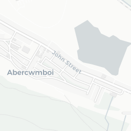
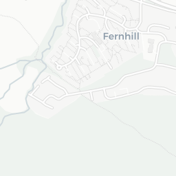
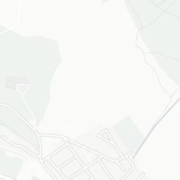
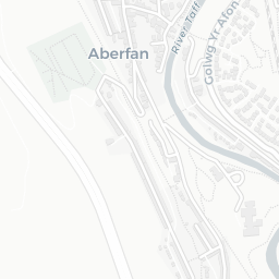
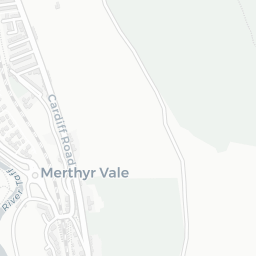
NestScope
CF45 4BL · Neighbourhood Report
© OpenStreetMap · © CARTO
Area Report
Last updated 13 JUN 2026

CF45 4BL

Neighbourhood Report

What's nearby — across walking, short-drive and school catchment distance. Data from official UK government sources.

NestScope Score
79/ 100

Partial score · Wales

A full NestScope Score relies on the England-only IMD backbone (plus schools, healthcare and crime data), so this is a partial score for Wales, based only on the layers actually covered here.

How this score is calculated
01 — Snapshot

Around CF45 4BL.

The large figure is how many we found nearby; the chip beside each label is that category’s NestScope score out of 100 — higher beats more of the UK.

Schools72/100
0Good/Outstanding within 1 mi

0 rated Good or better within 2 mi · 13 schools in total

No Good or Outstanding school within 2 mi

Safety

live count unavailable

Data temporarily unavailable

Healthcare81/100
3GP & hospitals

3 GP, 2 dentists, pharmacy 0.1 mi within 1.5 mi

Nearest GP: MOUNTAIN ASH HOSPITAL — 0.2 mi

Transport88/100
Mountain Ash Rail Station0.2 mi

21 bus stops also within 0.5 miles

Green space78/100
15green spaces

21.2 ha total — largest park 6.3 ha (0.33 mi away)

Nearest: Playground (200 m²) — 0.2 mi

Amenities77/100
3supermarkets

3 supermarkets within 2 mi — Morrisons, Iceland, The Co-operative Group — nearest 0.1 mi

Nearest: Morrisons Daily Mountain Ash — 0.1 mi

02 — Environment

Environment & risk near CF45 4BL.

Official risk flags for context — deliberately not part of the NestScope score (they’re categorical hazards, not amenities).

Flood risk
Zone 1 (low)

Flood Zone 1 — low risk (less than 1 in 1,000 annual chance) · Source: Environment Agency Flood Map for Planning

Zone 1
Zone 2
Zone 3
Air qualityWithin WHO guideline
6.3µg/m³

NO₂ annual mean · WHO guideline 10 · UK limit 40 · Source: DEFRA UK-AIR 2024

<10
10–20
20–30
30–40
≥40

About CF45 4BL

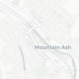
CF45 4BL scores 79/100 on the NestScope Score, with its strongest showing in transport and healthcare — with Mountain Ash Rail Station about 4 minutes' walk away. The breakdown below draws on official UK data covering schools, safety, healthcare, transport, environment and local amenities.

CF45 4BL sits outside England, so the national deprivation backbone (IMD) that anchors the NestScope Score isn't available — the figures below are based on local amenities only.

There are 13 schools within the typical catchment area. The nearest school is Caegarw Primary School, within a short walk.

Healthcare access is good, with 3 GP surgeries and 2 dental practices in the wider neighbourhood. The nearest GP practice is MOUNTAIN ASH HOSPITAL, about 4 minutes' walk away. A pharmacy is about 3 minutes' walk away.

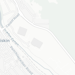
The nearest rail stations are Mountain Ash Rail Station (Train, about 4 minutes' walk away). There are also 21 bus stops within walking distance.

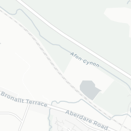
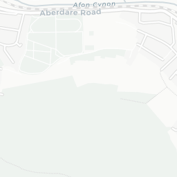
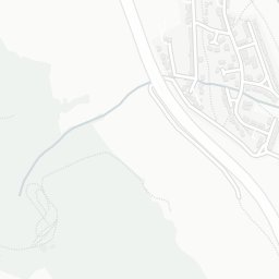
The location is in Flood Zone 1 (low risk — less than a 1 in 1,000 annual chance of river or sea flooding).

There are 15 green spaces within walking distance, totalling 21.2 hectares of parks and outdoor space. The nearest is Playground (200 m²), about 4 minutes' walk away.

There are 3 supermarkets in the wider area, including Morrisons, Iceland, The Co-operative Group. The nearest is Morrisons Daily Mountain Ash, about 3 minutes' walk away.

Sources: DfE/Ofsted, UK Police API, NHS ODS, NaPTAN, Environment Agency, Ordnance Survey, Natural England, DEFRA, Geolytix and Arts Council England. For an interactive map view, explore CF45 4BL on NestScope.

Explore area insights about nearby locations

Data: DfE/Ofsted · UK Police API · NHS ODS · NaPTAN · Ordnance Survey · Geolytix. Crown Copyright / OGL. Look up any postcode: nestscope.uk/area/YOUR+POSTCODE — e.g. SW1A 1AA, M1 1AE, BS1 1HT.

NestScope

All data from publicly available UK government sources. Each dimension uses a category-appropriate radius (walking distance for crime and transport, school catchment, drive distance for healthcare). IMD context is the latest published English Indices of Deprivation (2019). This report is for informational purposes only.