Area Report
Last updated 06 JUL 2026Neighbourhood Report
What's nearby — across walking, short-drive and school catchment distance. Data from official UK government sources.
01 — Snapshot
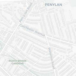
Around CF24 4QF.
The large figure is how many we found nearby; the chip beside each label is that category’s NestScope score out of 100 — higher beats more of the UK.
0Good/Outstanding within 1 mi
0 rated Good or better within 2 mi · 46 schools in total
No Good or Outstanding school within 2 mi
18crimes last month
18 crimes in 400m last month (residential-weighted: 14.2)
Crimes reported last month · UK Police API
25GP & hospitals
25 GP, 19 dentists, pharmacy 0.3 mi within 1.5 mi
Nearest GP: CRWYS MEDICAL CENTRE — 0.3 mi
No rail stations within 0.5 miles · 48 bus stops nearby
6green spaces
47.8 ha total — largest park 20.8 ha (0.49 mi away)
Nearest: Cemetery (21 ha) — 0.1 mi
64supermarkets
64 supermarkets within 2 mi — Tesco, Sainsburys, The Co-operative Group, Iceland… — nearest 0.3 mi
Nearest: Tesco Cathays Terrace Express — 0.3 mi
02 — Environment
Environment & risk near CF24 4QF.
Official risk flags for context — deliberately not part of the NestScope score (they’re categorical hazards, not amenities). Flood zones, air quality & noise explained.
Flood risk
Zone 1 (low)
Flood Zone 1 — low risk (less than 1 in 1,000 annual chance) · Source: Environment Agency Flood Map for Planning
Air qualityLow
14.1µg/m³
NO₂ annual mean · WHO guideline 10 · UK limit 40 · Source: DEFRA UK-AIR 2024
03 — House prices
Sold prices in CF24.
Average sold price by property type across the CF24 district, 2021–2026 — 3,755 sales.
About CF24 4QF
CF24 4QF scores 82/100 on the NestScope Score, with its strongest showing in schools and transport — with Fairoak Primary School about 5 minutes' walk away. The breakdown below draws on official UK data covering schools, safety, healthcare, transport, environment and local amenities.
CF24 4QF sits outside England, so the national deprivation backbone (IMD) that anchors the NestScope Score isn't available — the figures below are based on local amenities only.
There are 46 schools within the typical catchment area. The nearest school is Fairoak Primary School, about 5 minutes' walk away.
There were 18 crimes reported on the surrounding streets in the most recent month, indicating a moderate level of immediate-area crime.
Healthcare access is good, with 25 GP surgeries and 19 dental practices in the wider neighbourhood. The nearest GP practice is CRWYS MEDICAL CENTRE, about 5 minutes' walk away. A pharmacy is about 5 minutes' walk away.