NestScope
CB23 7DU · Neighbourhood Report
© OpenStreetMap · © CARTO
Area Report
Last updated 12 JUN 2026

CB23 7DU

Neighbourhood Report

What's nearby — across walking, short-drive and school catchment distance. Data from official UK government sources.

NestScope Score
81/ 100

One of the most affluent neighbourhoods in England

Anchored on official IMD data — decile 9/10, ranked 27,462 of 32,844 neighbourhoods in England.

How this score is calculated
01 — Snapshot

Around CB23 7DU.

The large figure is how many we found nearby; the chip beside each label is that category’s NestScope score out of 100 — higher beats more of the UK.

Schools92/100
0Good/Outstanding within 1 mi

1 rated Good or better within 2 mi · 3 schools in total

Nearest top-rated: Barton CofE VA Primary School (Good) — 2.0 mi

Safety82/100
3crimes last month

IMD crime decile 7/10 · 3 crimes in 400m last month (residential-weighted: 1)

Crimes reported last month · UK Police API

Healthcare76/100
1GP & hospitals

IMD health decile 10/10 · 1 GP, 1 dentist within 1.5 mi

Nearest GP: COMBERTON SURGERY — 0.0 mi

Transport62/100

No rail stations within 0.5 miles

Green space66/100
5green spaces

IMD environment decile 6/10 · 7.8 ha total — no proper park nearby

Nearest: Sports Facility (600 m²) — 0.0 mi

Amenities62/100
1supermarkets

1 supermarket within 2 mi — The Co-operative Group — nearest 0.1 mi — library 0.0 mi

Nearest: Co-op MRMF Comberton - West Street — 0.1 mi

02 — Environment

Environment & risk near CB23 7DU.

Official risk flags for context — deliberately not part of the NestScope score (they’re categorical hazards, not amenities).

Flood risk
Zone 1 (low)

Flood Zone 1 — low risk (less than 1 in 1,000 annual chance) · Source: Environment Agency Flood Map for Planning

Zone 1
Zone 2
Zone 3
Air qualityWithin WHO guideline
5µg/m³

NO₂ annual mean · WHO guideline 10 · UK limit 40 · Source: DEFRA UK-AIR 2024

<10
10–20
20–30
30–40
≥40
Road noiseQuiet
49dB Lden

Road traffic, day-evening-night average · Source: DEFRA strategic noise mapping

<55
55–64
65–74
≥75

About CB23 7DU

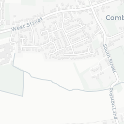
CB23 7DU scores 81/100 on the NestScope Score, with its strongest showing in schools and safety — with Comberton Village College within a short walk. The breakdown below draws on official UK data covering schools, safety, healthcare, transport, environment and local amenities.

In national context, CB23 7DU is one of the most affluent neighbourhoods in England — IMD decile 9/10, ranked 27,462 of 32,844 neighbourhoods in England. The Index of Multiple Deprivation is the UK government's official measure of relative deprivation, refreshed roughly every five years. Housing pressure here is high (IMD housing decile 2/10).

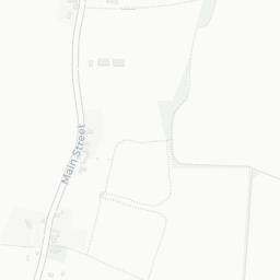
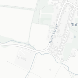
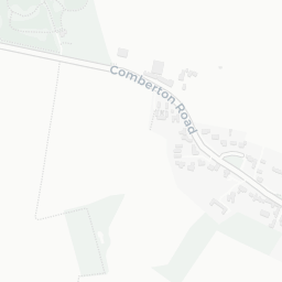
There are 3 schools within the typical catchment area, including 1 rated Good. The nearest school is Comberton Village College, within a short walk.

There were 3 crimes reported on the surrounding streets in the most recent month, indicating a very low level of immediate-area crime.

Healthcare access is available, with 1 GP surgery and 1 dental practice in the wider neighbourhood. The nearest GP practice is COMBERTON SURGERY, within a short walk.

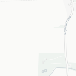
There are no public transport stops near CB23 7DU, making this a more car-dependent location.

The location is in Flood Zone 1 (low risk — less than a 1 in 1,000 annual chance of river or sea flooding). road traffic noise is low (about 49 dB Lden).

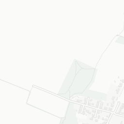
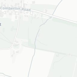
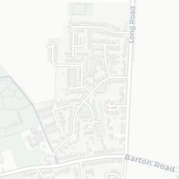
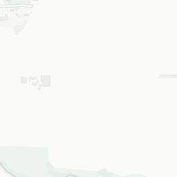
There are 5 green spaces within walking distance, totalling 7.8 hectares of parks and outdoor space. The nearest is Sports Facility (600 m²), within a short walk.

There is 1 supermarket in the wider area, including The Co-operative Group. The nearest is Co-op MRMF Comberton - West Street, about 2 minutes' walk away. A public library is within a short walk.

Sources: DfE/Ofsted, UK Police API, NHS ODS, NaPTAN, Environment Agency, Ordnance Survey, Natural England, DEFRA, Geolytix and Arts Council England. For an interactive map view, explore CB23 7DU on NestScope.

Data: DfE/Ofsted · UK Police API · NHS ODS · NaPTAN · Ordnance Survey · Geolytix. Crown Copyright / OGL. Look up any postcode: nestscope.uk/area/YOUR+POSTCODE — e.g. SW1A 1AA, M1 1AE, BS1 1HT.

NestScope

All data from publicly available UK government sources. Each dimension uses a category-appropriate radius (walking distance for crime and transport, school catchment, drive distance for healthcare). IMD context is the latest published English Indices of Deprivation (2019). This report is for informational purposes only.